Map Orientation
A map is oriented when it is made to correspond to the ground features it represents. If you know your location and can also identify the position of a distant object, you can orient your map by turning it so it corresponds to the ground features.
Get more information!
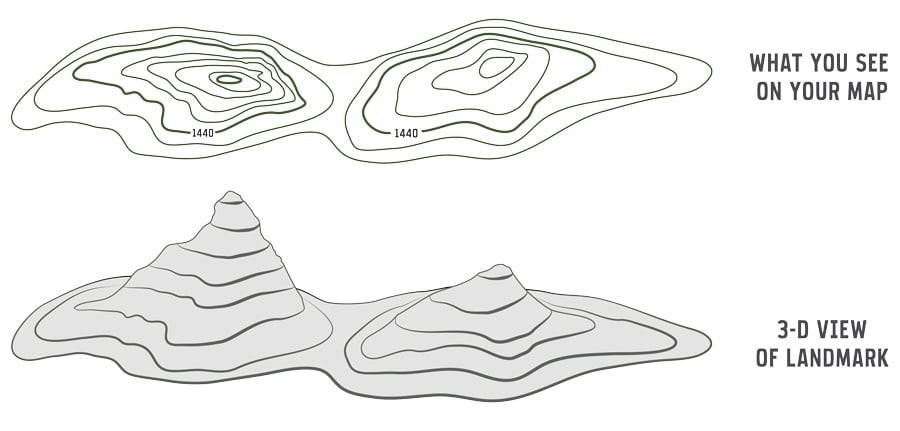
Contour Lines
Use contour lines to determine elevations of mountains and flat areas. The closer together the lines are, the steeper the slope. Note that contour numbers are often positioned differently, since they indicate the direction of elevation by always reading (pointing) uphill.
Get more information, see The Basics!
Water Features
Some water feature symbols also reveal water flow direction (e.g. direction of flow arrow in rivers, falls symbols pointing downstream).
Vegetation
At a glance, you can easily identify wooded areas (green) and clearings (white).
Aerial Photographs
Aerial photographs can enhance the use of your topographic map by providing an aerial view of the ground features shown on the map sheet. They are available for all NTS map sheets and may be obtained from the National Air Photo Library.
Get more information, see National Air Photo Library!