
A relatively easy hike along the North Saskatchewan River.
Distance: 1.91 km (return)
Elevation: 45m
Distance: 13.87km
Elevation Gain: 501m
From Highway 40 tern west into the Baldy Pass parking area.
Most people don’t hike the full trail as it requires 2 vehicles. This hike is accessed from the Lusk Creek day-use area on Highway6 68 The Sibbald Creek Trail. The pass is located between Mount Baldy and Midnight Peak. Some option routes are shown below where you can view their profiles as well as check out the map to get an overall view of the area.
Distance: 3.22km return
Elevation Gain: 591m
To get here head south on Highway 40 and turn left south of the Barrier Dam Road, then take your first left. An easy hike through the woods with lots of signage describing the area.
Distance: 2.36km (return)
Elevation Gain: 34m
This hike is accessed from Barrier Lake day-use area. This is a easy hike around a very popular destination, especially on weekends.
Distance: 3.35km (return)
Elevation Gain: 127m
A steep hike into an area used for rock climbing.
Distance: 1.43km (one-way)
Elevation Gain: 406m
Distance: 512m (one-way)
Elevation Gain: 40m
From Highway 40 turn West onto Mount Allan Drive, then your first left followed by your first right into the Ribbon Creek day-use area. Some scrambling is required on this hike. As well as certain sections of this trail maybe closed, call Kananaskis Information at 1-403-678-0760 for more info if considering this advanced hike. This trail I have described here take you to the top of Mount Allan at 2832m above sea level.
Distance: 15.72km (return)
Elevation Gain: 1013m
This hike is accessed from the Eau Claire campground off Highway 40. It is an easy hike to the Kananaskis River, make sure to bring your camera as some nice views can be seen from here.
Distance: 731m (return)
Elevation Gain: 5m
Accessed from the Elpoca day-use area off of Highway 40, this day use area has been a drop-off point for roadkill in the past. Be Bear Aware on this hike. From the top the view of Elpoca Mountain is phenomenal.
Distance: 4.85m (return)
Elevation Gain: 659m
Park at the Evan-Thomas day-use are off Highway 40. This trail is mainly accessed by horse, mountain bike or skis during the winter but I included the profiles below for Evan-Thomas Creek Trail from Evan-Thomas Pass Trail and the Evan-Thomas Pass Trail
Distance: 19.9km
Elevation Gain: 671m
A short hike to a beautiful lake with The Fortress as a backdrop.
Distance: 3.81m (return)
Elevation Gain: 175m
Accessed from Fortress Mount Ski Area off of Highway 40, park by the barricade. This relatively moderate hike features some amazing view of Mount Kidd and of the Kananaskis Village Ski resort. As well as a powerful view of the Fortress itself. A side trip can be made out to Fortress Lake with a return of 3.81km , I recommend this as a must do, see Fortress Lake Trail from Fortress Ridge Trail.
Distance: 6.07m (one-way)
Elevation Gain: 300m
Accessed along Highway 40 at the Galatea Creek Parking Lot. This is a super popular hike, especially on weekends. Accessed from the Galatea Creek parking lot. This hike makes its way from the parking lot down to the Kananaskis River where you will use a suspension bridge to cross it, from here it crisscrosses Galatea Creek multiple times using wooden bridges until its makes its way, after which you cross multiple avalanche paths as you make you way towards the final ascent up to Lillian Lake.
If your adventurous enough, and looking for a beautiful alpine lake you can continue west and head up to Galatea Lakes with an elevation of around 180m. This area up here also the start for Guinn’s Pass which I’ve posted the profile to below. It is only 1.4km to the pass from near Galatea Lakes with an elevation gain of 216m. Don’t be fooled by the short distance to this hike from the lake. This climb deserves respect. Treat it as so. From the pass you can also access Quinn’s Peak 2617m. Just remember this will make for a long day, if you are planning this I suggest spending 2 nights at Lillian Lake Backcountry Campground so you can enjoy this trip and take in the sights, your body will thank you.
Distance: 9.23km (one-way)
Elevation Gain: 705m
Accessed from the Pocaterra Cirque Route. This hike is for experienced hikers only. This short trail connects Pocaterra Cirque Route with the Grizzly Ridge Route and also offers access to Mount Trywhitt (2874m), Grizzly (2770m) as well as offers amazing views of the Paradise Valley to the south.
Distance: 1.18km (one-way)
Elevation Gain: 101m
This advanced scrambling trail starting at the southern end of Grizzly Col Route. Upon reaching Grizzly Peak (Highwood Pass) you can scramble to Highwood Ridge but this side trip offers a fare deal of exposure, so keep that in mind if planning to go that way. A slip here could lead to some serious injuries or worse.
Distance: 1.8km (return)
Elevation Gain: 152m
Accessed from the Grizzly Creek pull-off on Highway 40 this short hike follows Grizzly Creek. But like the name says, make sure to carry bear spray on you and know how to use it.
Distance: 1.36km (return)
Elevation Gain: 112m
Access this trail from North of Ripple Creek which is the first creek you come to when going south from the Grizzly Creek turnoff on Highway 40. This scramble roughly follows Ripple Rock Creek as you head towards Grizzly Peak. From the top you are rewarded with great views of Mount Lawson (3849m) and Mount Inflexible (3000m) to the west. You can return from Grizzly Peak via Grizzly Peak South Ridge Route which I posted the profile of below.
Distance: 5.59km (return)
Elevation Gain: 833m
Starting near Grizzly Column this trail for experienced hikers follows the southern ridge as it makes its way toward a junction with Highwood Ridge Route.
Distance: 4.03km (one-way)
Elevation Gain: 548m
Accessed from the Highwood Meadows day-use area off Highway 40 this hike has There is a relatively steep scramble near the beginning but the view of the Highwood Pass from the top overlooking the parking lot makes for some really nice views, especially if done early in the morning. From amazing views to section of scree and a connector to Grizzly Ridge Route at the end, you can also access Mount Trywhitt from here but that makes for a long day up Grizzly Ridge Route. The views from the Highwood Ridge Route of Paradise Valley will leave you breathless, highly recommend this hike to be done in mid-July to late August as the scenery then is at its prime.
Distance: 7.14km (one-ay)
Elevation Gain: 553m
Accessed from Highway 68 The Sibbald Creek Trail at the Lusk Creek day-use area. From here you start climbing the south ridge of the hill along a forested trail as you make you way to the top which offers a great view of the Fisher Range.
Distance: 4.68km (return)
Elevation Gain: 369m
A short hike through tall pine forest to a ridge.
Distance: 2.24km (return)
Elevation Gain: 99m
Turn into the Barrier Lake Road from Highway 40. While this trail can appear long, you do have the option on a pleasant day of kayaking or canoeing across the lake and follow the creek up to the pass. You can also access this hike by Prairie View Trail.
Distance: 14.86km (return)
Elevation Gain: 536m
One of the more difficult scrambles in K Country. A fall here would be life threatening. Please make sure you have a lot of experience scrambling before you try and bag this particular Peak.
Distance: 6.12km (one-way)
Elevation Gain: 955m
Access from the King Creek day-use area off Highway 40 this hike leads you up a canyon into Grizzly and Bighorn Sheep territory, remember your bear spray and if travelling with pets, make sure they are on a leash. This area is a popular destination and leads to the Stoney religious site.
Distance: 1.51km (one-way)
Elevation Gain: 136m
Accessed at King Creek day-use area off Highway 40, this is a strenuous hike up to the top, but the views from the top at 2423m above sea level make it all worthwhile. Wow There is also an optional trail you can view of the map as well as see in the King Creek Ridge Southeast Route profile below.
Distance: 6.92km (return)
Elevation Gain: 713m
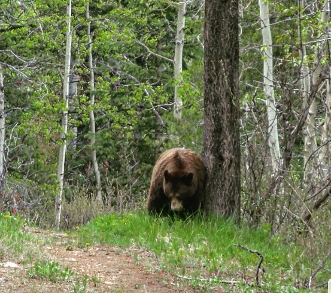
From Highway 40 turn West onto Mount Allan Drive, then your first left and follow it to Kananaskis Village, turn onto Terrace Drive and park in the Mount Kidd Manor parking lot. A hilly scenic walk that is well signed through the forest near Kananaskis Village, remember to be Bear Aware as it was off this trail where I encountered multiple black bears, and also came the closest I have ever been to a Grizzly Bear.
Distance: 6.92km (one-way)
Elevation Gain: 147m
There are two different routes you can choose from, this one and a route from the south. To access the Limestone Mountain Northwest Route 3 I suggest parking at the Galatea Creek parking lot. This a basic scramble with some nice views once you ascend above the treeline, with minimal exposure near the summit ridge.
Distance: 4.17km (return)
Elevation Gain: 583m
This hike can be accessed from the Highwood Meadows day-use area via the Pocaterra Ridge Trail or approach it from the North across from the trail to Gap Mountain. For more information see Kananaskis Country Trail Guide Volume 1 Page159.
Distance: 12.78km (return)
Elevation Gain: 744m
This trail cuts off the trail to Lillian and Galatea Lakes, see Galatea Lake via Lillian lake Trail as I have this hike as a side path starting from that trail. This hike starts just before you cross Galatea Creek for the 7th time. Leave the trail your on to Lillian Lake and go straight then head southwest up the bank and continue onto Quinn’s Lost Lake.
Distance: 5.9km (return)
Elevation Gain: 211m
Park at the Evan-Thomas day-use are off Highway 40. I have this trail starting at the end of the Evan-Thomas Creek Trail from Evan-Thomas Pass Trail. This is a moderate Ridge walk which enable you to hit 3 grassy summits.
Distance: 6.26km (one-way)
Elevation Gain: 789m
Access from the Ribbon Falls Trail this hike leads you on an enchanted journey toward three beautiful mountain lakes, which require some scrambling in section, but totally worth it, Bogart Tower and Ribbon Peak can also be accessed from this trail. If you choose this hike you will not regret it.
Distance: 10.49km (return)
Elevation Gain: 636m
Accessed and exited from two different areas along the Baldy Pass Trail, this steep hike will make you earn it as you hike up a forested trail to the top.
Distance: 3.67km (one-way)
Elevation Gain: 785m
This hike along with the connecting routes make (profiles below) make for a great day of scrambling with panoramic views from the top, plus bagging two summits in one trip. Sunrises from the top are amazing.
Distance: 6.21km (return)
Elevation Gain: 767m
From Highway 40 turn West onto Mount Allan Drive, then your first left and follow it to Kananaskis Village, turn onto Terrace Drive and park in the Mount Kidd Manor parking lot. A short side trip off the Kovach Trail with 592m of elevation gain. which offers an impressing view of Kananaskis Village along with Mount Boggart (3044m) and Mount Sparrowhawk (3121m) to the west and to the east, the G8 Summits including The Wedge (2667m) and Old Baldy (2728m) among others.
Distance: 2.06km (one-way)
Elevation Gain: 592m
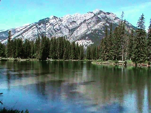
A popular area for people fishing in the summer and generally a nice walk, on a clear day with no wind, the reflection of Mount Lorette is nice from here as it is mirrored on the pond. There are also a few areas where you can have a fire, as long as no fire bans are in effect. This area is regularly patrolled as people fish here so obey all signs, warnings etc.
Distance: 1.46km (return)
Elevation Gain: 10m
Two climbers died in separate incidents in 2003. Be careful when nearing the top due to loose footing.
Distance: 5.92km (return)
Elevation Gain: 1045m
Starting at the Evan-Thomas Creek Parking lot, Follow the Evan-Thomas Pass Trail until you reach the forks, choose the trail marked by cairns to head towards Old Baldy. This hike crisscrosses McDougall Creek a few times before it ascends toward the top. You can also access this from Old Baldy alt Route, see the map and check out below for the profile.
Distance: 14.81km (return)
Elevation Gain: 1186m
Accessed from the Fortress Junction Gas Station on Highway 40, this hike ends with beautiful views of the Wedge to the North and Kananaskis Lakes to the south. This is considered a scrambling route so be prepared.
Distance: 3.55km (one-way)
Elevation Gain: 965m
Starting at the end of the Elpoca Creek Hill Route this adventure requires some serious route-finding skills as it makes its way toward Opal King Column (2332m) all the way south to Gap Mountain (2675m). Be aware that this is a difficult hike for most and consider, bringing a topo map if you choose to do this hike or a GPS with extra batteries or a way to charge it.
Distance: 14.95km (return)
Elevation Gain: 309m
Starting just before Hood Creek on east side of Highway 40 this steep scramble gains elevation fast as it heads for the summit, this is an advanced forested hike as some route finding maybe needed.
Distance: 2.98km (return)
Elevation Gain: 595m
Accessed from Highwood Pass day-use area off Highway 40 this hike is perfect for ‘Larch Madness’ in the fall. This hike also shares its access with Highwood Ridge Route which make for multiple adventures depending on where you want to go.
Distance: 8.03km (return)
Elevation Gain: 452m
For this hike park near the Porcupine Creek bridge. The Porcupine Creek Trail is a relatively easy hike for those looking to get away from it all and have a relaxing hike. If you make it to the end of this hike and want more of a challenge you can continue east along the creek on the Porcupine Creek Northeast Fork or go southeast and go up the Porcupine Ridge Trail. Both profiles for the side routes are available below. The Porcupine Ridge trail is for more advanced hikers who are used to scrambling.
Distance: 730m (one-way)
Elevation Gain: 24m
To get here take the Barrier Lake Road when heading south on Highway 40. A very popular hike with one steep climb. The Barrier Lookout Trail up to Yates Mountain can also be added on for a 590m one way hike to the top with 124m of elevation gain.
Distance: 7.43km (one-way)
Elevation Gain: 504m
Distance: 590m (one-way)
Elevation Gain: 124m
From Highway 40 turn west into the Baldy Pass parking area.
Most people don’t hike the full trail as it requires 2 vehicles. This hike is accessed from the Lusk Creek day-use area on Highway6 68 The Sibbald Creek Trail. The pass is located between Mount Baldy and Midnight Peak. Some option routes are shown below where you can view their profiles as well as check out the map to get an overall view of the area.
Accessed by the Highwood Meadows day-use Area off Highway 40, this area is known for Grizzly Bear sightings, so be Bear Aware and make sure to have your spray in an easily accessible area and not in your backpack. A relatively easy hike that has a small waterfall waiting for you halfway through it. This trail offers amazing 360-degree panoramic shots of the mountains and an alpine meadow.
Distance: 3.58km (return)
Elevation Gain: 213m
Starting from the Elbow Pass day-use area off Highway 40 this hike combines the Rae Glacier with Elbow Lake and makes for a great hike as most people stop at Elbow Lake. But the views along the way to the glacier are definitely worth checking out. If you decide to only go to Elbow Lake then you only encounter about 140m of elevation, give or take.
Distance: 8.33km (return)
Elevation Gain: 394m
From Highway 40 turn West onto Mount Allan Drive, then your first left followed by your first right into the Ribbon Creek day-use area. One of my favorite, all-time hikes in Kananaskis, from the Ribbon Creek as it makes its way toward Ribbon Falls. Many waterfalls can be viewed along this popular hike. Fresh water in the form of Ribbon Creek offers no excuse to get thirsty if you have a way to purify it. Sections of this trail are not recommended in the winter as they pass avalanche terrain. Above the falls is a section which uses a series of chains to reach Ribbon Lake. See Ribbon Falls to Ribbon Lake profile below. Most either camp near the falls or return the same way they entered. I found the return leg to be a lot faster (as I only took half the number of photos coming back as I did walking in). The return trip is mostly a decline in elevation which you will be thankful for.
Distance: 9.13km (one-way)
Elevation Gain: 416m
A short connector from Troll Falls to the Skogan Pass Trail or vice versa.
Distance: 354m (one-way)
Elevation Gain: 42m
Accessed from the Ribbon Creek day-use area after turning west from Highway 40 onto Mount Allan Drive. A relatively moderate hike blanketed in forest with multiple places to fill your LifeStraw Bottle along the way or water bottle if you have a way to purify it.
Distance: 21.35km (return)
Elevation Gain: 606m
A scramble involving brutal bushwhacking from the Galatea Lakes via Lillian Lake Trail. This trail is accessed prior to Bridge number 2 on the Lillian Lake trail to Galatea Lakes.
Distance: 6.71km (return)
Elevation Gain: 648m
Accessed from the Troll Falls trailhead just off of Mount Allen Drive (on the right-hand side of the road) in Kananaskis Village after crossing the bridge. This trail follows a powerline access road and a part of the old Highway 40 road and offer some breathtaking views, as it passes multiple routes.
Distance: 23.15km (one-way)
Elevation Gain: 153m
Accessed from the Skogan Pass Trail this hike is basically a way to get to the Hummingbird Plume Lookout Tower which is now surrounded by forest. This hike makes for an awesome side trip, a must do if you have the time.
Distance: 2.73km (return)
Elevation Gain: 135m
From Highway 40 turn West onto Mount Allan Drive, then take your first left and follow it to Kananaskis Village, turn onto Terrace Drive and park in the Mount Kidd Manor parking lot. Even though I show the distance for the whole trail along with the profile for the total trail starting at the junction with Galatea Lake via Lillien Lake Trail. Below that profile, I have broken this trail into 2 sections: Terrace Trail South, (south from Kananaskis Village to the junction with Galatea Lake via Lillien Lakes Trail which is 8.27km one way with 89m of elevation) and Terrace Trail North (north from Kananaskis Village which is 2.4km one way with 75m of elevation) to make it easier depending on where you want to go.
I personal love the Terrace Trail and try to hike it at least once in the Spring, Summer, Fall and Winter of each year and it never fails to disappoint. A great way to clear your mind while taking in some amazing sights. I have encountered White Tailed Deer, Black Bear, and Grizzly Bear along this hike plus multiple species of birds and small mammals. Remember even though it is popular, you are still in Bear and Mountain Lion Country so be sure to have bear spray, better to be safe than sorry.
Distance: 10.66km (one-way)
Elevation Gain: 88m
Park at The Wedge Pond parking lot off Highway 40. A relentless uphill leg burner which offers amazing views of the Kananaskis Valley.
Distance: 3.84km (one-way)
Elevation Gain: 1071m
Accessed from the Troll Falls trailhead just off of Mount Allen Drive (on the right-hand side of the road) in Kananaskis Village after crossing the bridge. A super popular hiking trail leading to a waterfall. This parking lots fills up quite quickly on weekends and holidays as many families venture here. Remember to carry bear spray as bears have been reported in this area every year. Pay attention to any signs which are posted near the parking lot. You can continue along this path from the falls along the Marmot Creek Trail which I posted the profile below for. There are some hidden gems if you continue along this trail.
Distance: 3.35km (return)
Elevation Gain: 57m
Starting from Old Baldy Trail, this path is best done in early morning to avoid the heat on the exposed slopes once you head east from Old Baldy Trail towards Volcanoe Peak as this area is more exposed as you can see in the profile below. This hike offers solitude as it doesn’t see heavy foot traffic.
Distance: 2.86km (one-way)
Elevation Gain: 832m
Accessed from the Wasootch Creek parking lot this is a strenuous hike up to a popular Kananaskis ridge location, if you continue to the summit this hike does become more technical. Only go as far as you feel comfortable doing so. I’ve provided profiles for other routes in this area below and you can also view them on the map, and they are also available in Kananaskis Country Trail Guide Volume 1. If you have any question on the other hikes in this area, feel free to send me a message here, and I’ll do my best to help you out, as I myself hike quite often, there could be a delay in my response, I apologize in advance. Thank you.
Distance: 13.13km (return)
Elevation Gain: 833m
Accessed from the Canoe Meadows day-use area. A relatively easy peaceful hike along the Kananaskis River.
Distance: 2.88km (return)
Elevation Gain: 15m
| Trail | Distance | Elevation Gain | Terrain |
| Aspen Trail | 1.91km (one-way) | 45m | Scramble/bushwhack along stream bed to a waterfall |
| Baldy Pass Trail | 13.87km (one-way) | 501m | Steady rugged hike through the forest |
| Mount Baldy South Ridge Route | 3.22km (return) | 591m | Very easy hike |
| Barrier Lake Forestry Trail | 2.36km (return) | 34m | Easy hike through forest and grassland |
| Barrier Lake Interpretive Trail | 3.35km (return) | 127m | Advanced leg burner to the top |
| Barrier Lake Trail | 512m (one-way) | 40m | A steady easy hike with minor elevation |
| Centennial Ridge Trail | 15.72km (return) | 1013m | Advanced technical climb |
| Delta Wall Trail | 1.43km (one-way) | 406m | A steep hike into an area used for rock climbing |
| Eau Claire Interpretive Trail | 731m (return) | 5m | An upward backcountry hike |
| Elpoca Creek Hill Route | 4.85km (return) | 659m | A forested path with a small scramble section |
| Evan Thomas Pass | 19.9km (one-way) | 671m | A mix of boardwalks and beat down paths toward the first falls |
| Fortress Lake trail from Fortress Ridge Trail | 3.81km (return) | 175m | A short hike to a beautiful lake with The Fortress as a backdrop |
| Fortress Lake Trail & Fortress Lake Alternate | 6.07km (one-way) | 300m | Moderate hike with moderate elevation |
| Galatea Lake via Lillian Lake Trail | 9.23km (one-way) | 705m | Long advanced hike |
| Grizzly Col Route | 1.18km (one-way) | 101m | A moderate scramble |
| Grizzly Col to Grizzly Peak (Highwood Pass) | 1.8km (return) | 152m | Advanced scrambling trail |
| Grizzly Creek Trail | 1.36km (return) | 112m | Easy hike with moderate elevation |
| Grizzly Peak Route | 5.59km (return) | 833m | Advance scramble, exposed areas |
| Grizzly Ridge Route | 4.03km (one-way) | 548m | For experienced hikers. Proceed with caution |
| Highwood Ridge Route | 7.14m (one-way) | 553m | A steep scramble which offers great views |
| Horton Hill Route | 4.68km (return) | 369m | Leg burner with moderate elevation |
| Hotron Ridge Route | 2.24km (return) | 99m | Short hike through tall pine forest to a ridge |
| Jewell Pass | 14.86km (return) | 536m | Moderate hike with challenging elevation |
| Kananaskis Peak Route | 6.12km (one-way) | 955m | Difficult scramble, a fall here would be life threatening |
| King Creek Canyon Trail | 1.51km (one-way) | 136m | Easy hike with little elevation |
| King Creek Ridge Route | 6.92km (return) | 713m | Strenuous hike to the top |
| Kovach Trail | 6.92km (one-way) | 147m | An easy hike, carry bear spray |
| Limestone Mountain Northwest Route | 4.17km (return) | 583m | A scramble with moderate elevation |
| Little Highwood Pass Trail | 12.78km (return) | 744m | An advance scramble |
| Lost Lake Route | 5.9km (return) | 211m | Moderate hike, tricky t find turn off |
| MacKay Hills Lower Route | 6.26km (one-way) | 789m | Moderate ridge walk with some elevation gain |
| Memorial Lakes Trail | 10.49km (return) | 636m | Advance hike to modrate scramble |
| Midnight Peak Trail | 3.67km (one-way) | 785m | Steep hike on a forested trail |
| Mount Baldy Circuit Route | 6.21km (one-way) | 767m | Mid level scramble |
| Mount Kidd Lookout Trail | 2.06km (one-way) | 592m | Moderately steep hike |
| Mount Lorette Ponds Trail | 1.46km (return) | 10m | Easy walk around a lake |
| Mount Lorette Route | 5.92km (return) | 1045m | Advance hike, caution needed |
| Old Baldy Trail | 14.81km (return) | 1186m | An advanced hike/ scramble |
| Opal Ridge | 3.55km (one-way) | 965m | Scrambling with steep quick elevation |
| Opal Traverse Route | 14.95km (return) | 309m | Difficult hike, route finding skills needed |
| Packenham Junior Route | 2.98km (return) | 595m | Advanced hike, route finding needed |
| Pocaterra Ridge Trail | 8.03km (return) | 452m | Moderate hike |
| Porcupine Creek Trail | 730m (one-way) | 24m | Easy relaxing hike |
| Prairie View Trail | 7.43km (one-way) | 504m | Forested trail, steep climb |
| Barrier Lookout Trail | 590m (one-way) | 124m | Short easy trail, can be extended |
| Ptarmigan Cirque Route | 3.58km (return) | 213m | Easy hike with minimal elevation |
| Rae Glacier via Elbow Lake Route | 8.33km (one-way) | 394m | Moderate hike with elevation gain |
| Ribbon Falls Trail | 9.13km (one-way) | 416m | Moderate hike and elevation, alavanche risk in Winter |
| Ruthies Trail | 354m (one-way) | 42m | A short connector trail |
| Skogan Pass Trail | 21.35km (one-way) | 606m | Long hike with mid-level elevation gain |
| Spoon Needle Route | 6.71km (return) | 648m | Brutal bushwacking scramble |
| Stoney Trail | 23.15km (one-way) | 153m | Long trail with minimal elevation |
| Sunburst Trail | 2.73km (return) | 135m | Short side trip |
| Terrace Trail | 10.66km (one-way) | 88m | Long hike with elevation changes |
| The Wedge Route | 3.84km (one-way) | 1071m | A relentless uphill leg burner |
| Troll Falls Trail | 3.35km (return) | 57m | Reletively easy hike for family |
| Volcanoe Peak Route | 2.86km (one-way) | 832m | Advanced scramble with exposed slopess |
| Wasootch Ridge Trail | 13.13km (return) | 833m | Strenuous popular hike |
| Widowmaker Trail | 2.88km (return) | 15m | An easy hike along a river |
The maps, GPS data and elevations on profiles are provided for reference purposes only and to help you plan you next outdoor adventure. Maps can be used for navigation and you can open them up in Caltopo for a better viewing experience. Backcountry Views makes no guarantees, representations or warranties respecting this data, either expressed or implied. Backcountry Views assumes no responsibility for damages or other liabilities due to the accuracy, availability, use or misuse of the information provided. I use the information provided within this website to help plan my hikes from elevations to different types of terrain. This info is free to use, as I want to help everyone have a safe enjoyable time while hiking, thank you very much. I hope you find this info to be a benefit to you. For updates follow me at backcountryviewsofficial on Instagram.


