
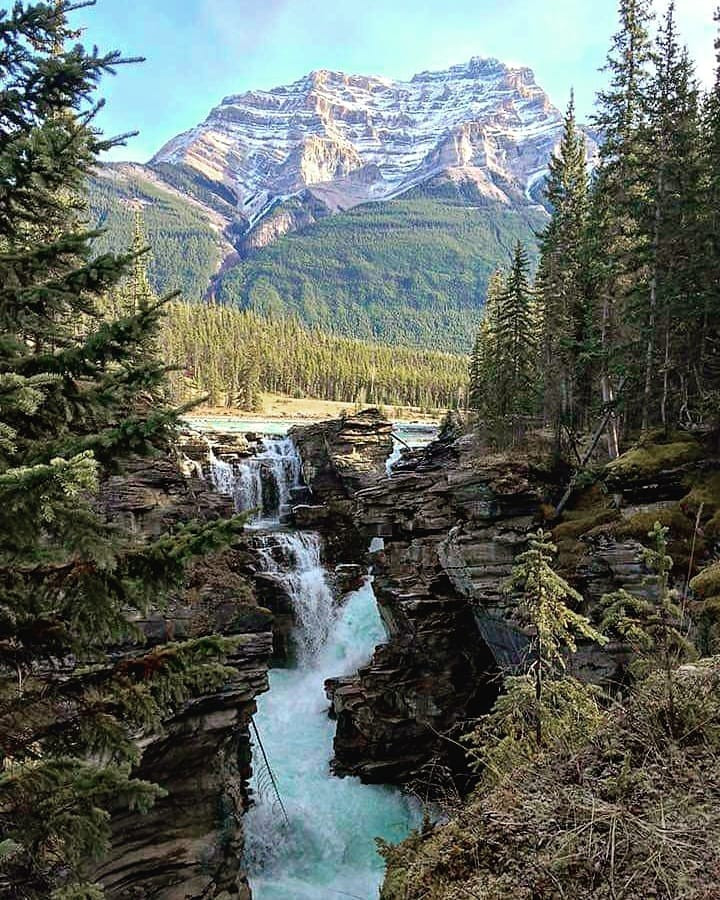
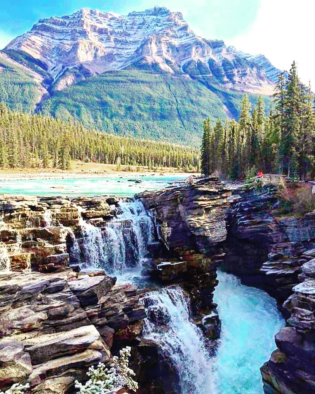
Access from the Athabaska Falls day-use area (roughly 33kms from the town of Jasper and about 200kms from Lake Louise), this family friendly popular hike features a waterfall flowing 23m over a cliff, and is considered a Class 5 waterfall.
Distance: 1.79 km (return)
Elevation: 20m
National Park: Jasper
Distance: 1.47km (return)
Elevation Gain: 147m
National Park: Banff
Located roughly 86km south on Highway 93 from the lights in Jasper this hike starts where you drive over 2 large water diversion dikes that go under Highway 93 approximately 2km south of the beauty creek hostel. This hike follows beauty creek and features a series of little waterfalls as you make your way to Stanley Falls. With only 120m of elevation this is one hike you are sure to enjoy.
Distance: 3.88km (return)
Elevation Gain: 120m
National Park: Jasper
This trail is accessed roughly 16 south of the Columbia Icefield Discovery Centre along the Big Bend turn just past where it loops around. Continue driving and turn right onto an obscure, unpaved road which drops below the highway. There is an old concrete bridge, park just before the bridge. This trail is kind of tricky to find. I drove by it the first time lol. This scramble features multiple different areas with scree but offers some of the best views of the Columbia Icefields of any trail along Highway 93.
Distance: 12.22km (return)
Elevation Gain: 1083m
National Park: Banff
This hike is accessed from a parking lot opposite the Columbia Icefield Discovery Centre (see map for more info if needed) by a road that I closed to public traffic, but you’re allowed to walk to the trailhead 1km roughly up this road. Be careful of buses taking tourists, remember they have the right of way and probably cannot stop on a dime. This trip offers you two scree slopes to choose from as you make y6our ascent to the top. The choice is yours. Not much difference between them. Be sure to take a camera as the surrounding views of British Columbia and Alberta are amazing, from Hilda Peak (3060m) to Mount Athabasca (3491m in the south to Mount K2 (3092m) to the west among others. I highly recommend this hike; you will not regret it.
Distance: 8.25km (return)
Elevation Gain: 838m
National Park: Jasper
A relatively moderate hike with a minimal gain of only 233m which offers maximum rewards, with views of glaciers, Peyto Lake, the Bow River as well as Caldron Peak (2911m) rising to the NW. This is one hike where you might not want to forget your camera.
Distance: 5.93km (return)
Elevation Gain: 233m
National Park: Banff
From the Bow Lake parking lot head to the right of Bow Lake as you make your way counterclockwise around the lake until you reach a set of stairs. Go up the stairs to Bow Glacier Falls, from the top continue the path as you head towards the waterfall. This hike is breathtaking and one I highly recommend.
Distance: 7.9km (return)
Elevation Gain: 127m
National Park: Banff
DO NOT ATTEMPT THIS HIKE IF SNOW LIES ON THE SLOPE BELOW PEYTO PEAK, AS THIS COULD LEAD TO A FATAL FALL OVER CALDRON FALLS.
The best time to do this hike is in August to mid-September just to be safe. Bring extra shoes as this trip does involve the crossing of some runoff from the Peyto Glacier. This hike features some very steep sections as it leads toward the lake. Once at the lake you are greeted by majestic views of Peyto Peak (2970m) and the Peyto Glacier to the south along with Mistaya Mountain (3078m) to the west.
Distance: 13.95km (return)
Elevation Gain: 575m
National Park: Banff
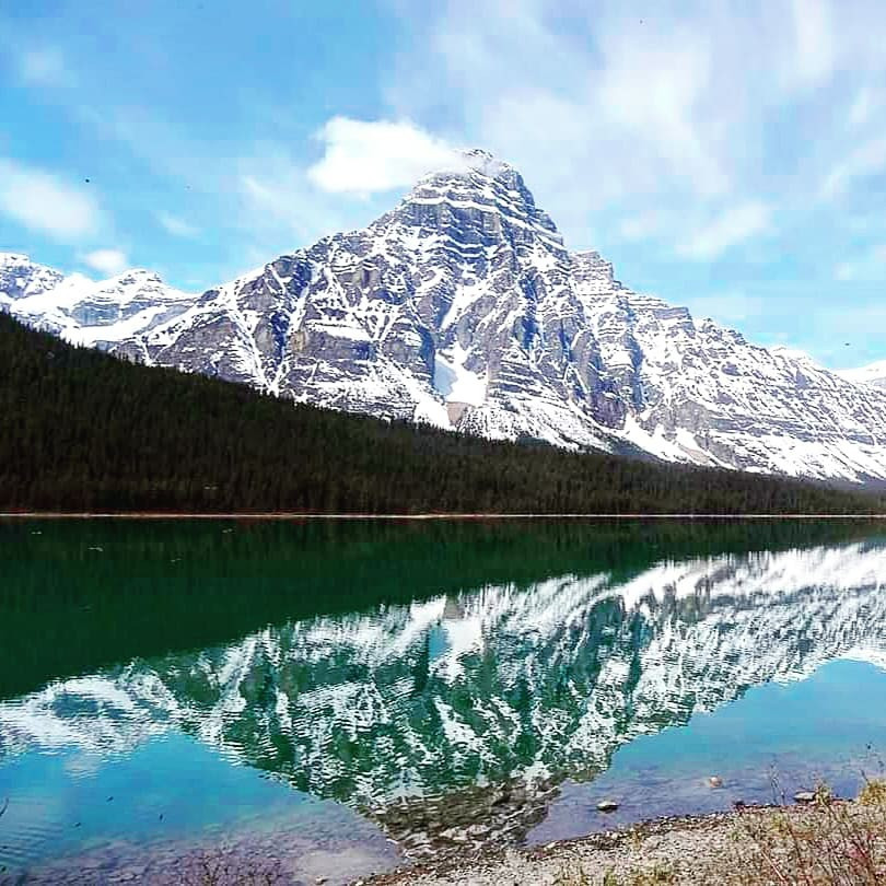
This trail starts from the Waterfowl Lakes Campground This hike predominant follows a meadow up to the lake which often has wildlife grazing in it as you make your way towards the lake. This is worth checking out if you haven’t been here.
Distance: 7.26km (return)
Elevation Gain: 100m
National Park: Banff
This trail starts from the Waterfowl Lakes Campground and ends near a boulder field which continues out into Cirque Lake. You should have this trail to yourself as it is very rarely hiked. Stairway Peak (2999m) and Aries Peak (2996m) can be seen to the south with Midway Peak (2871m) to the west.
Distance: 8.33km (return)
Elevation Gain: 153m
National Park: Banff
Starting out, you are met with your biggest task, crossing the Sunwapta River, once across you follow Wooley Creek as it ascends up the valley gradually gaining elevation till the final steep ascent to the summit from a scree covered south approach. This hike requires experience, not one for beginners or moderate hikers.
Distance: 18.73m (return)
Elevation Gain: 1747m
National Park: Jasper
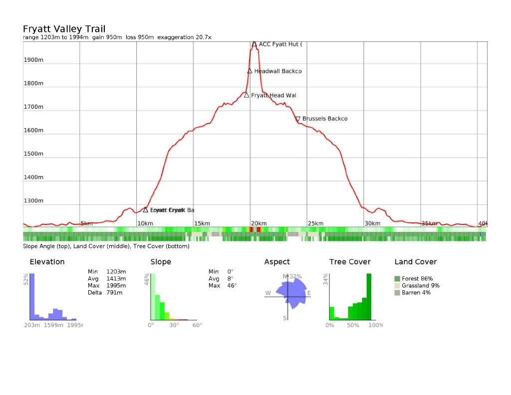
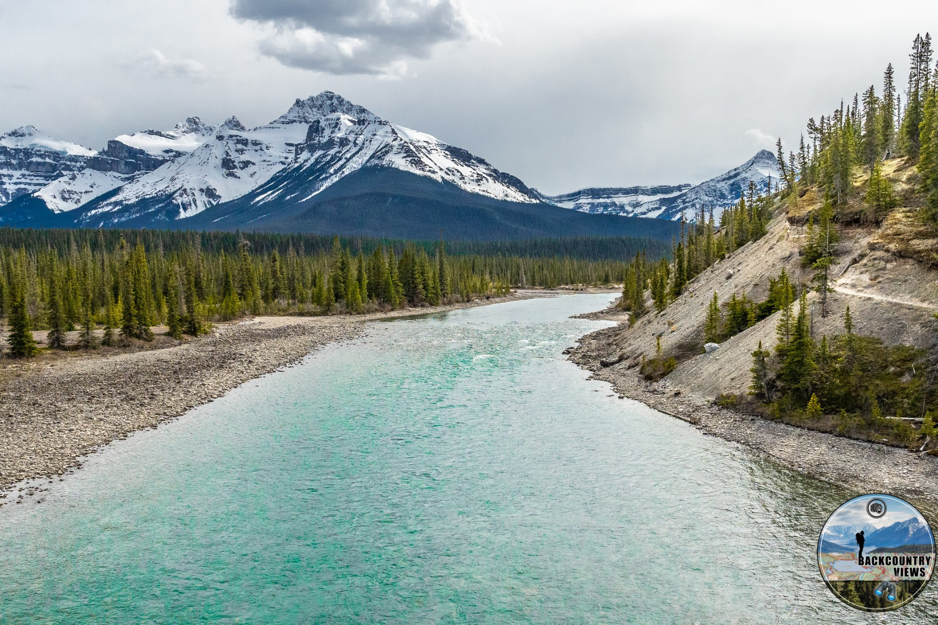
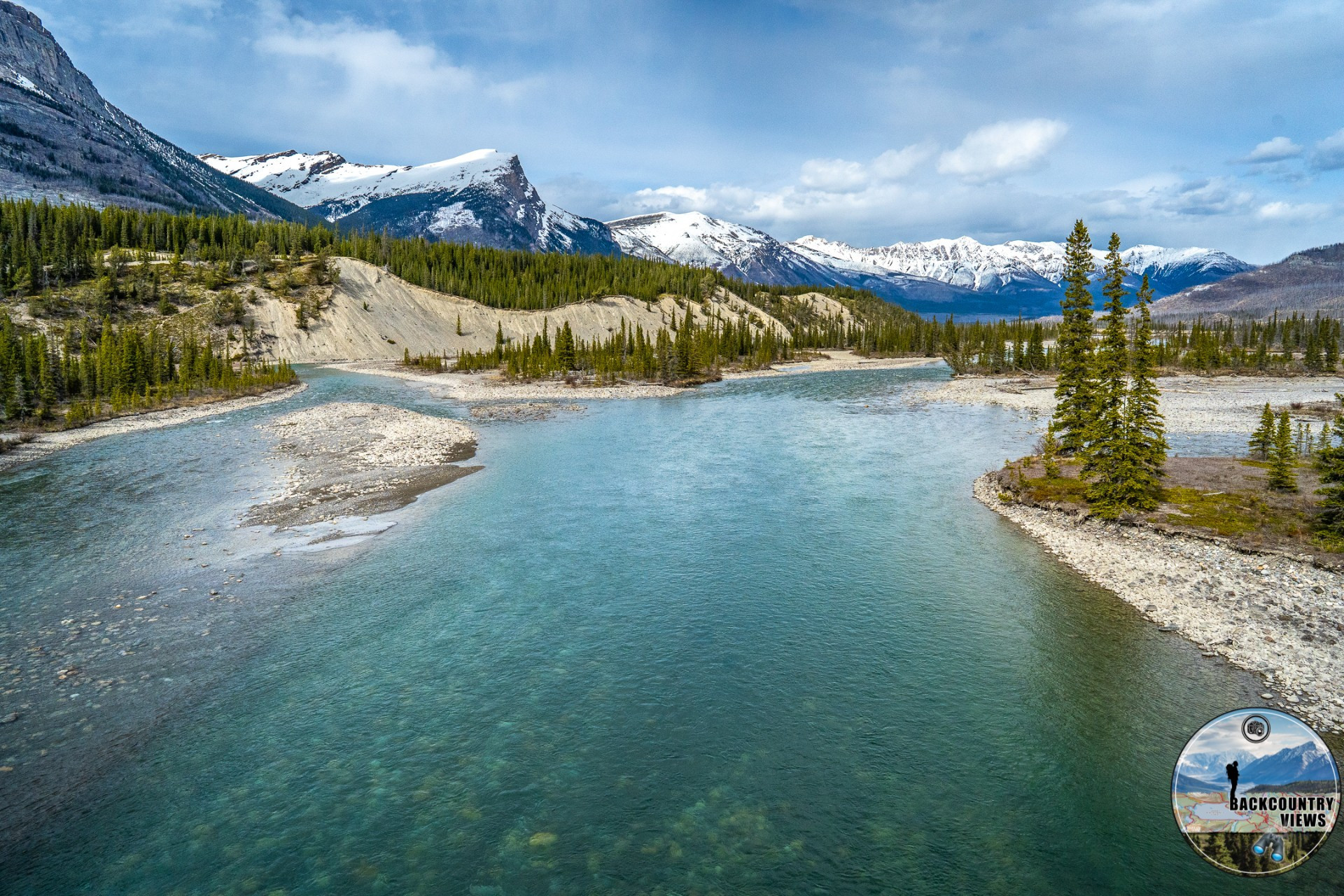
Heading south from Jasper on Highway 93 The Icefields Parkway turn onto Geraldine Road, continue another 2km, trailhead is on your left-hand side. This first leg of this journey offers breathtaking views of the Athabasca River Valley as you make your way to the Lower Fryatt Backcountry Campground. From here you enjoy a beautiful forested hike as you make Your way towards Brussels Backcountry campsite (roughly 6km from the previous campsite) which offers scenic views of Mount Christie (3103m) to the East, Mount Fryatt (3361m) to the West, with Mount Xerxes (2970m) and Mount Olympus (2987m) rising from the south. Views of Brussels Peak (3261m) and Mount Lowell (3150m) welcome you from the southeast. A beautiful area with an easily accessible source of water awaits you here and makes for a nice place to tent down for the night and enjoy the stars above. Shortly after leaving this area, after a short distance you start to follow near the shoreline of Fryatt Lake as you make you way towards the Headwall Backcountry Campground where you get to admire the beautiful what I call Fryatt Creek Falls which the campground sits at the base of. Such a peaceful place. If you choose to go farther, a brutal roughly 900 m uphill hike will take you to the ACC Hut (Sydney Vallance Hut).
Distance: 40.88km (return)
Elevation Gain: 791m
National Park: Jasper
This trail is usually snow and ice free in late spring, as you head out along this well beaten forested path which crosses both the North Saskatchewan River and the Howse River with Mount Murchison making an excellent background for photo lovers like myself. After here it is mainly a forested hike broken up by huge patches of Buffalo Berries (IF HIKING IN JULY AND AUGUST MAKE SURE TO HAVE BEAR SPRAY AS GIZZLY BEARS LOVE TO FEAST ON THEM) Within approximately 9km from the trailhead you will arrive at Glacier Lake Backcountry Campground, the trail does follow the northern shore of this lake if you want to continue heading west for just over 3.5km one way. Makes for a nice late afternoon hike. There are 5 spots to put a tent here each with firepits and dogs are allowed on this hike. These sites do need to be booked in advance, and the maximum stay is 3 nights I believe. You can book the campsite though Parks Canada, you can continue past the campsite for a roughly 18 km round-trip side excursion which offers some impressive views.
Distance: 35.09km (return)
Elevation Gain: 244m
National Park: Banff
Accessed roughly 18km north from where you turn onto the parkway near Lake Louise take you to a beautiful lake nestled in between Pulpit Peak (2725m) and Crowfoot Mountain (3050m). Hector Lake is one of the largest natural lakes in Banff National Park. Just be careful when crossing the Bow River. Check on the current river conditions prior to attempting this hike.
Distance: 3.16km (return)
Elevation Gain: 60m
National Park: Banff
Accessed 1km south of Bow Lake at the Helen Lake parking lot. Multiple tree roots greet you on the well-worn path as you make your way east around Crystal Ridge, a beautiful meadow greets you on your way towards Helen Creek as it flows southeast into the valley below. Continue up a short moderate elevation gain and before you if Helen Lake with Cirque Peak rising to the North of the lake. Continue past here and up the headwall for some great panoramic views before you descend into Lake Katherine. From here you can return the way you came, or you can continue onto Lake Alice if you are feeling energetic and time permits. It is roughly 8km return to Lake Alice and back from Lake Katherine.
Distance: 15.71km (return)
Elevation Gain: 544m
National Park: Banff
A relatively easy hike that follows the southern shore of Hector Lake west towards your destination. From Lake Margaret you can do an exposed scramble to Turquoise Lake if you feel comfortable but remember if you do not have the skill there is a high risk of injury in the event of a fall. Be careful.
Distance: 13.15km (return)
Elevation Gain: 69m
National Park: Banff
From the trailhead to Avalanche backcountry campground you gain around 580m of elevation as you make your way along Poboktan Creek before heading northwest to the campground. Once you start heading Northeast its about 4.5km to the campsite (only one group can book per night, which is a bonus meaning you will have this beautiful area all to yourself). From here you can leave what you don’t need and make a quick roughly 11+ km hike to Maligne Pass and Maligne Pass Lake, and continue on past some gorgeous Alpine Lakes, that very few get to see, or you can return the way you went back to the campsite. Personally, I recommend doing the loop, book the campsite for two nights and enjoy all the amazing scenery around Maligne Pass.
Distance: 33.88km (return)
Elevation Gain: 802m
National Park: Jasper
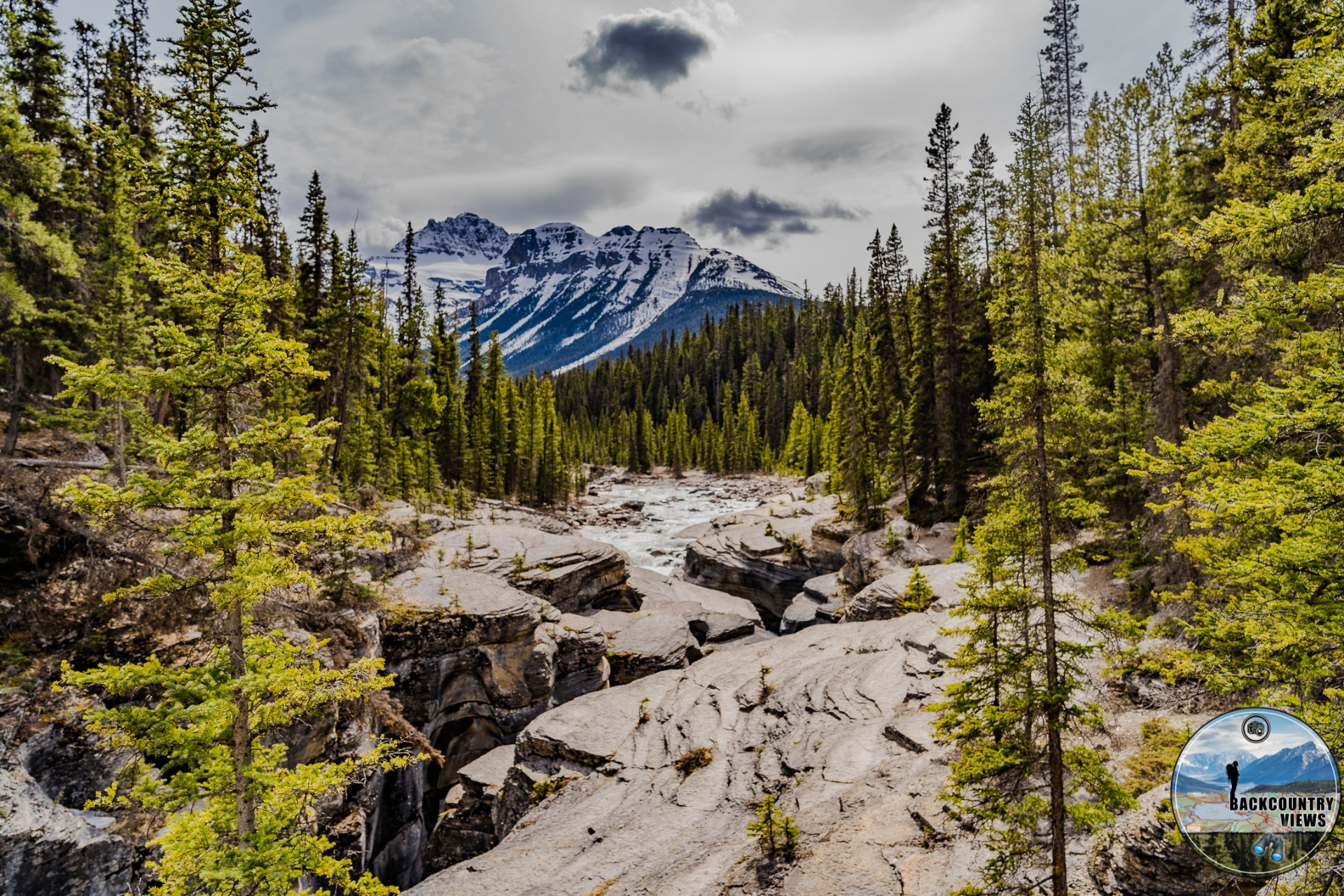
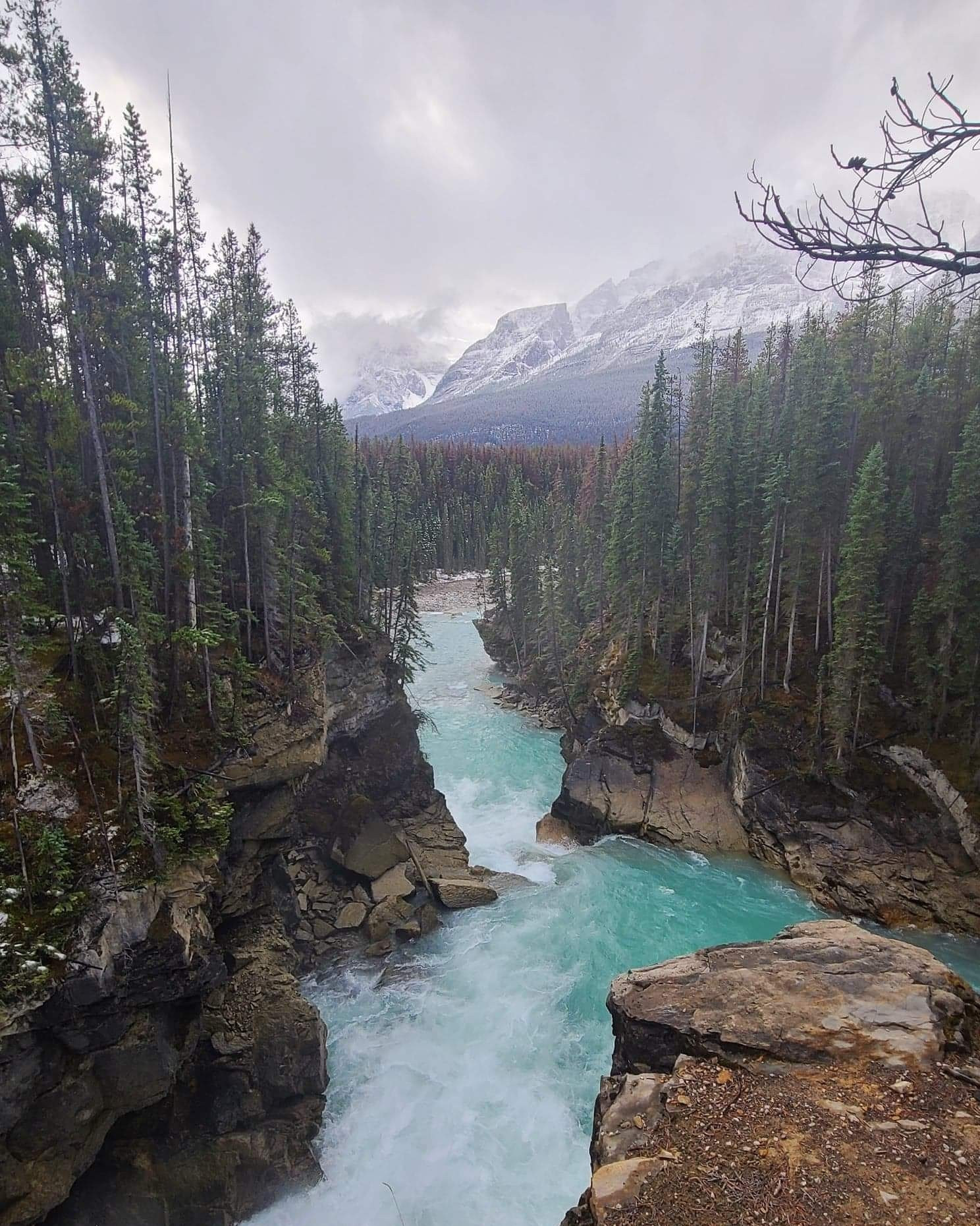
To access this trail, drive about 130km north of Banff on Highway 93 to the Mistaya Canyon parking lot, if you come to Highway 11 you have gone too far. An easy but often missed hike. Follow the gravel path from the parking lot down to Mistaya River and Mistaya Canyon, this is relatively easy hike that can be done by most people.
Distance: 1.73km (return)
Elevation Gain: 47m
National Park: Banff
Accessed across from the Mosquito Creek Wilderness Hostel, this moderate hike takes you through Grizzly Bear country, make sure to carry your Bear Spray as you head up the forested trail towards Mosquito Creek Backcountry Campground. From the campsite there are multiple peaks you can summit. I have listed the profiles for them all below as well as I have them marked out on the accompanying map.
Distance: 17.45km (one-way)
Elevation Gain: 1074m
National Park: Banff
Located about 3 km south of the Icefield Centre on Highway 93 on the left-hand side of the Wilcox Creek Campground entrance. Greeted in the first kilometer by a moderately steep ascent. The ascent levels off as you pass the tree line and reach the wide-open Wilcox Pass area. From here a steady scramble leads you up Mount Wilcox to the summit, this mountain used to be known just as Wilcox Peak but was later changed to Mount Wilcox. Bighorn Sheep are commonly seen grazing in the meadows along this area. Best hiked in mid-July to end of August or middle of September depending on weather of course. Snow has been seen here in late July to early August, just a heads up for everyone.
Distance: 13.75km (return)
Elevation Gain: 808m
National Park: Jasper
Go north from Banff on Highway 93 for 24km and turn into the Mosquito Creek Campground. This hike features a beautiful alpine meadow that will take your breath away. It starts by following Mosquito Creek up to the Mosquito Creek Backcountry Campground as it heads counterclockwise around Noseeum Mountain (3002m) before heading south-east along the northeast face of the mountain. Roughly 2.5km past the campground you come to the junction with a wooden sign, from here take the path going left to North Molar Pass as you are soon greeted by a huge meadow after roughly a km through a forested section. The meadow is best viewed in early August. Continuing you will arrive at the shallow Mosquito Lake – a great spot to rest. Before your final ascent to North Molar Pass.
Distance: 23.06km (return)
Elevation Gain: 753m
National Park: Banff
From Lake Louise head North on Highway 93 toward Jasper for around 41km. Turn right at Bow Summit into a parking area. This is an advanced scramble it features 2 very difficult section. Rocky cliff band just past the halfway mark take a little more skill to traverse than is needed prior to them. The second difficult/potentially dangerous part involves around 150m of loose scree that can become problematic when the ground freezes as it will cause the scree on top to slide when you walk on it. Be super careful and take another route if possible or choose a different hike if attempting this in the fall. If attempting in the summer, be extra careful here.
Distance: 8.2km (return)
Elevation Gain: 1044m
National Park: Banff
Distance: 12.5km (return)
Elevation Gain: 1081m
National Park: Banff
Access this hike approximately 120km north of Lake Louise on Highway 93 at the pullout at the top of Big Bend Hill. This relatively easy hike features a few waterfalls with the two most notable being Panther Falls which shoots out from a small opening in a cliff and Bridal Falls which is a high multi layered waterfall. A side trail near Panther Falls leads down to Nigel Creek, which I highly recommend using MicroSpikes to access it with because of the mist making this steep descent slippery.
Distance: 1.27km (return)
Elevation Gain: 78m
National Park: Banff
Accessed 9km south of the Columbia Icefield Discovery Centre just past the Hilda Creek Wilderness Hostel this hike follows switchbacks to the top of the ridge, seeing Mountain Goats is not uncommon here. Continue this trail down the other side for an amazing view of the Saskatchewan Glacier.
Distance: 5.02km (return)
Elevation Gain: 248m
National Park: Banff
This trail is accessed roughly 16 south of the Columbia Icefield Discovery Centre along the Big Bend turn just past where it loops around. Continue driving and turn right onto an obscure, unpaved road which drops below the highway. There is an old concrete bridge, park just before the bridge.
This trail follows the North Saskatchewan River to the Saskatchewan Glacier. I did this trip in the second week of July and viewed multiple waterfalls along this off beaten path. Route finding is required but the views are totally worth it.
Distance: 10.41km (return)
Elevation Gain: 107m
National Park: Banff
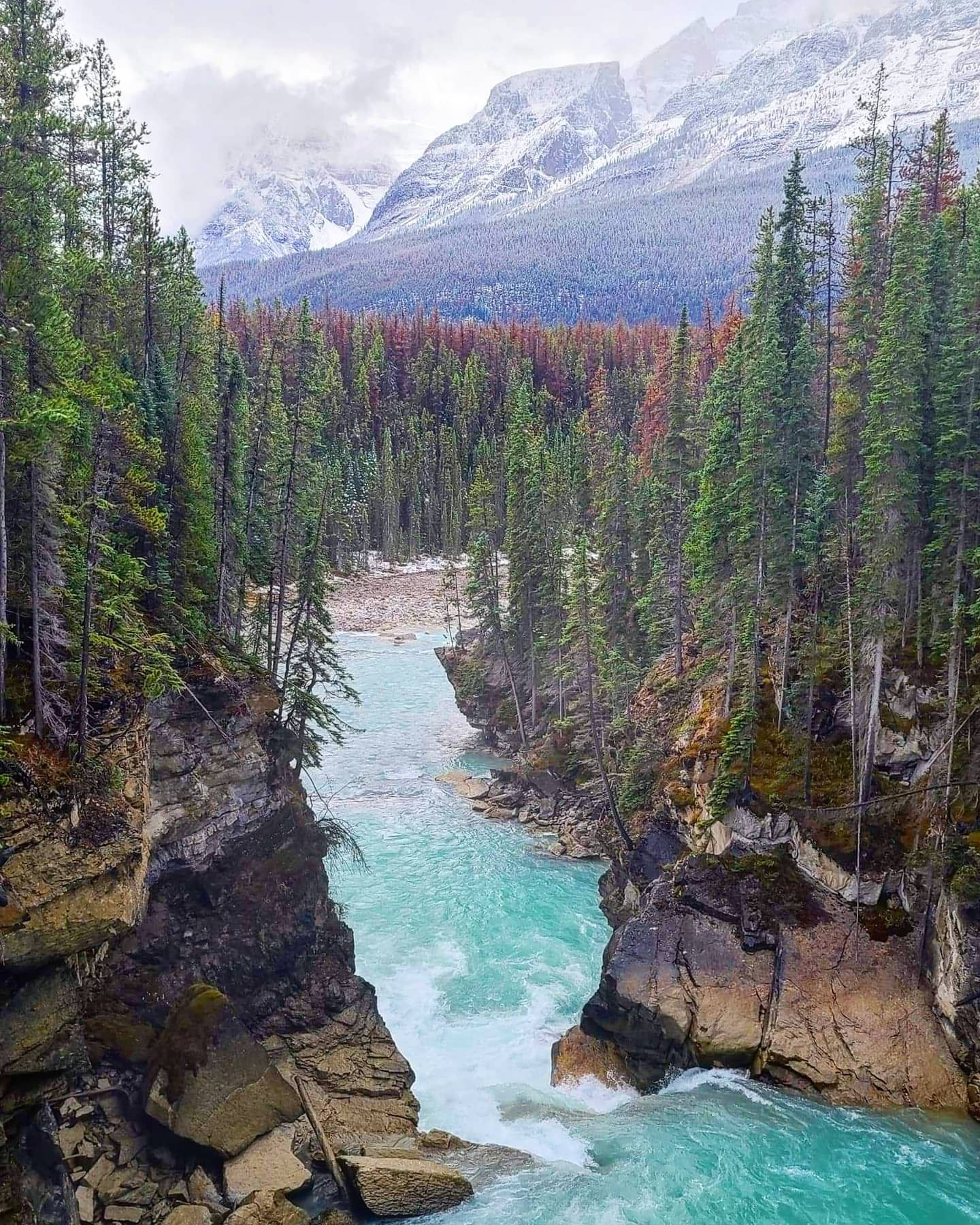
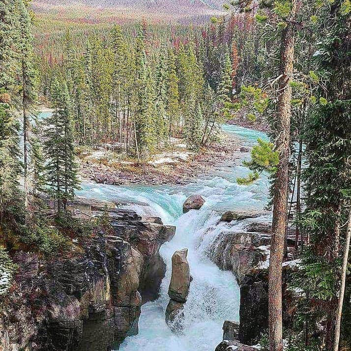
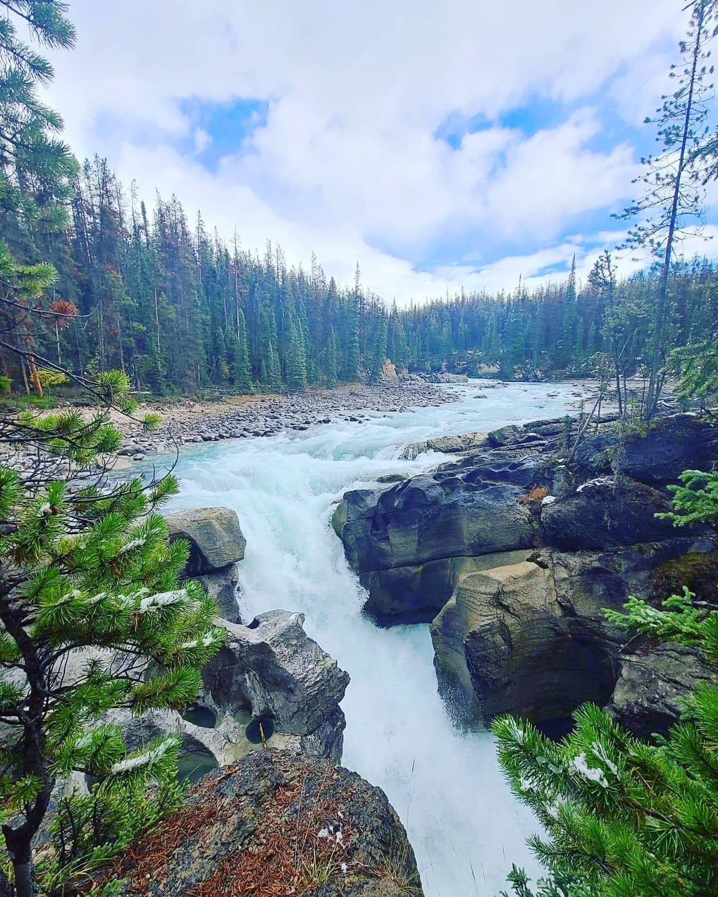
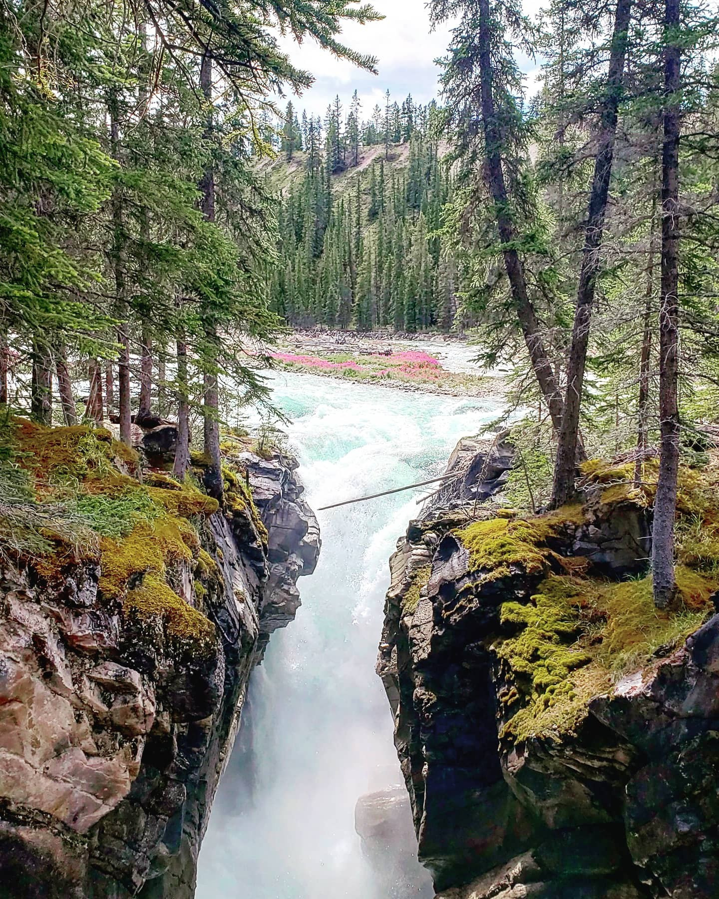
Drive south from Jasper on Highway 93 The Icefields Parkway for 55km, turn right at the Sunwapta Falls Resort, and continue to the end of the road. Once you park a short easy hike down to bridge where you can view the falls awaits you. You can also follow the trail with the sign that says Lower Sunwapta Falls, here you are met with beautiful views of the Sunwapta Canyon in addition to a few more waterfalls. Then a final little scramble downhill puts you on the shore of the Sunwapta River and offers some impressive views upstream including a waterfall. This hike is quite popular but do take the time to walk this area as it is truly amazing.
Note – If you cross the bridge from where you are viewing the waterfalls, that trail leads you to the Trail to Fortress Lake in British Columbia which is just over 46kms return.
Distance: 3.12km (return)
Elevation Gain: 80m
National Park: Jasper
Located roughly 86km south on Highway 93 from the lights in Jasper this hike starts where you drive over 2 large water diversion dikes that go under Highway 93 approximately 2km south of the beauty creek hostel.
Welcome to scrambling 101, just kidding, this 1709m gain of elevation in roughly 6 km is for advanced scramblers, face it that equals out to 5606 feet of elevation, but you do pass a few waterfalls along the way as well as several spots where the water cascades down creating miniature waterfalls, once above the tree line you are greeted by every scramblers best friend, scree lol, and the ridgeline is a steep as the slope, this is definitely a leg burner.
Distance: 11.68km (return)
Elevation Gain: 1709m
National Park: Jasper
This scenic hike starts by passing Tangle Falls and then starts following the Wilcox Pass Trail as it heads up towards some cairns which mark the beginning of the ascent to tangle ridge where you are greeted by scree slopes as you make your way to the top. A challenging hike which is broken up by some beautiful scenery.
Distance: 9.99km (return)
Elevation Gain: 1101m
National Park: Jasper
Accessed at the end of Toes of the Glacier Road, across from the Columbia Icefield Discovery Centre. This is a relatively easy hike over some glacially smoothed limestone which was under the ice in the 1950’s. The scratches you can see within the limestone are aligned with the ice flow path of the glacier.
Warning - Walking on the Athabasca Glacier is not safe. The ice at the toe of the glacier is hollow and is collapsing. The underlying water is extremely cold and fast moving.
Over the years several people have died from falling into crevasses. These ice-cold cracks in the ice are hidden below a thin covering of snow that may collapse under a person’s weight.
The above warning, I copied straight from the parks Canada website, as I don’t want to see anyone get hurt. Falling into a crevasse would not only be bad for you, but it would put all emergency responders at risk as well.
Distance: 1.84km (return)
Elevation Gain: 89m
National Park: Jasper
A tall post with a small wooden sign marks the trailhead. This is a super easy hike leading to a lake as it approximately follows the North Saskatchewan River.
Distance: 3.24km (return)
Elevation Gain: 2m
National Park: Banff
ROCKFALL IS A KNOWN HAZARD ON THIS HIKE This a relentless hike up scree to the summit. The only reason I am mentioning this hike is for those who do decide to do it will know rockfall is a real hazard on this scramble.
Distance: 7.65km (return)
Elevation Gain: 1284m
National Park: Banff
Located roughly 86km south on Highway 93 from the lights in Jasper this hike starts where you drive over 2 large water diversion dikes that go under Highway 93 approximately 2km south of the beauty creek hostel.
You can also access this hike from the Wilcox Creek Campground, from that entry point it is a much shorter hike with around 1oo meters less of elevation. This hike is best done in Late July to the end of August as it features Big Horn Sheep, beautiful peaceful meadows as well as the views of the surrounding glaciated peaks including Snow Dome (3456m) and Mount Andromeda (3450m) among others. This is a roughly 8-12-hour hike return if you start near tangle falls depending on fitness level or a 2-3 hours return if you choose to just hike to the pass from the Wilcox Creek campground. Bighorn Sheep have a chance to be spotted from both entry points, but I recommend the tangle creek entry point as the views are majestic, and usually less crowded.
Distance: 16.98km (return)
Elevation Gain: 523m
National Park: Jasper
A short trail leading to an area popular with Ice Climbers.
| National Park | Trail | Distance | Elevation Gain | Terrain |
| Jasper | Athabaska Falls Interpretive Trail | 1.79km (return) | 20m | Scramble/bushwhack along stream bed to a waterfall |
| Banff | Balfour Wall Route | 1.47km (return) | 147m | Steady rugged hike through the forest |
| Jasper | Beauty Creek to Stanley Falls Trail | 3.22km (return) | 591m | Very easy hike |
| Banff | Big Bend Peak Route | 12.22km (return) | 1083m | Easy hike through forest and grassland |
| Jasper | Boundary Peak Route | 8.25km (return) | 838m | Advanced leg burner to the top |
| Banff | Bow Glaciers Falls Trail | 7.9km (return) | 127m | A steady easy hike with minor elevation |
| Banff | Bow Summit Trail | 5.93km (return) | 233m | Advanced technical climb |
| Banff | Caldron Lake Trail | 13.95km (return) | 575m | A steep hike into an area used for rock climbing |
| Banff | Chephren Lake Trail | 7.26km (return) | 100m | An upward backcountry hike |
| Banff | Cirque Lake Trail | 8.33km (return) | 153m | A forested path with a small scramble section |
| Jasper | Diadem Peak Route | 18.73km (return) | 1747m | A mix of boardwalks and beat down paths toward the first falls |
| Jasper | Fryatt Valley Trail | 40.88km (return) | 791m | A short hike to a beautiful lake with The Fortress as a backdrop |
| Banff | Glacier Lake Trail | 35.09km (return) | 244m | Steady walk with a scramble |
| Banff | Hector Lake Trail | 3.16km (return) | 60m | Be careful crossing the Bow River |
| Banff | Helen Lake Trail to Lake Katherine | 15.71km (return) | 544m | Steady leg burner |
| Banff | Lake Margaret Trail | 13.15km (return) | 69m | Easy hike following a lake shore |
| Jasper | Maligne Pass Loop Trail | 33.88km (return) | 802m | High elevation but worth the reward |
| Banff | Mistaya Canyon Trail | 1.73km (return) | 47m | An easy hike, don't go right after the viewpoint bridge |
| Banff | Mosquito Mountain Route | 17.45km (one-way) | 1074m | Advanced technical climb |
| Jasper | Mount Wilcox Route | 13.75m (return) | 808m | Advanced hike with steep ascend |
| Banff | North Molar Pass Trail | 23.06km (return) | 753m | Advanced lengthy hike |
| Banff | Observation Peak Route | 8.2km (return) | 1044m | Advance hike with steep elevation gain |
| Banff | Noseeum Lake via Noseeum Peak Route | 12.5km (return) | 1081m | Advanced hike |
| Banff | Panther Falls Trail | 1.27km (one-way) | 78m | Relatively easy hike to a waterfall |
| Banff | Parker Ridge Trail | 5.02km (one-way) | 248m | A nice ridge hike to view Mountain Goats |
| Banff | Saskatchewan Glacier Access Trail | 10.41km (return) | 107m | Advanced hike with route finding required |
| Jasper | Sunwapta Falls Trail | 3.12km (return) | 80m | Popular hike to a waterfall |
| Jasper | Sunwapta Peak | 11.68km (return) | 1709m | Advanced scrambling |
| Jasper | Tangle Ridge Route | 9.99km (return) | 1101m | A challenging hike with beautiful scenery |
| Jasper | Toe of the Athabasca Glacier Trail | 1.84km (return) | 89m | Easy hike to a glacier |
| Banff | Warden Lake Trail | 3.24km (return) | 2m | Easy hike to a lake |
| Banff | Weed Mountain Route | 7.65km (return) | 1284m | A relentless hike up scree to the summit, rockfall is a known hazard |
| Jasper | Wilcox Pass Trail | 16.98km (return) | 523m | Advanced hike with majestic views |


