
To access this trail, go west of the Nordegg turnoff a little bit on Highway 11 and turn right on Shunda Creek Road, follow this till you can turn right on Baldy Mountain Road. Follow this road to the gate where there is a small parking area. Take your camera for this one as the panoramic view at the top feature’s foothills and the Rocky Mountains, this is aided by the roughly 462m elevation gain you can view on the profile below. Be aware in the winter that some parts of Shunda Mountain are in avalanche terrain.
To access this trail, go west of the Nordegg turnoff a little bit on Highway 11 and turn right on Shunda Creek Road, follow this till you can turn right on Baldy Mountain Road. Follow this road to the gate where there is a small parking area. This trail starts from the parking lot at Fish Lake (Shunda Lake) and I suggest going counter clockwise around the lake to roughly the 2km mark, you will come to a junction of two trails, don’t go left here as that returns you around the lake to the parking lot. Blue Herons can be seen along some of the swamps you pass along this trail. There are a few other trails that criss cross as you continue, I suggest carrying the David Thompson Highway Hiking Guide with you so you can get the most out of this hike, it helped me immensely.
Distance: 8.05 km
Elevation: 462m
Distance: 18.1km
Elevation Gain: 203m
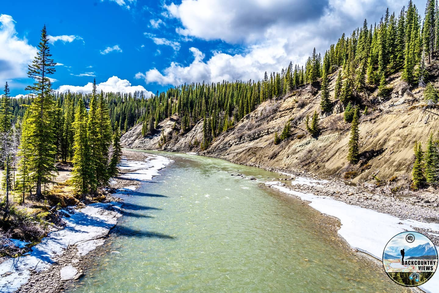
Park your vehicle at the Nordegg Heritage Centre (it’s the yellow building roughly 1km south of Hwy 11 in Nordegg – 4002 Stuart Street, Nordegg, Alberta, T0M 2H0). This steady hike offers amazing views, from the lookout tower you can view clearly Eagle Mountain as well as the entire Brazeau Mountain Range. This hike also passes two abandoned strip mines along the journey, this trail is predominantly covered by forest, so bear spray is recommended on this hike. Even though this trail follows a creek prior to the first strip mine and ends near Dutch Creek, having extra water is recommended when taking this trail, as it is roughly 22km long and with 553m of elation gain as you can see in the profile below.
Distance: 22.52km
Elevation Gain: 553m
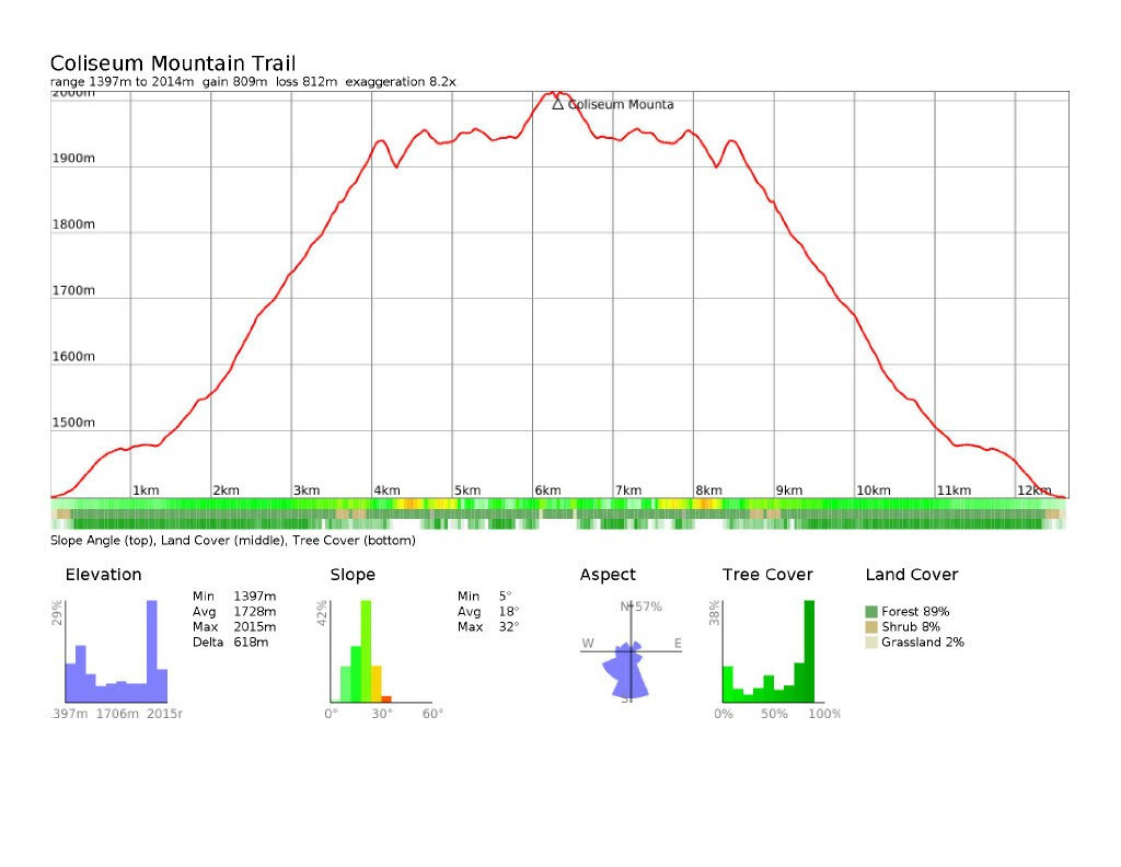
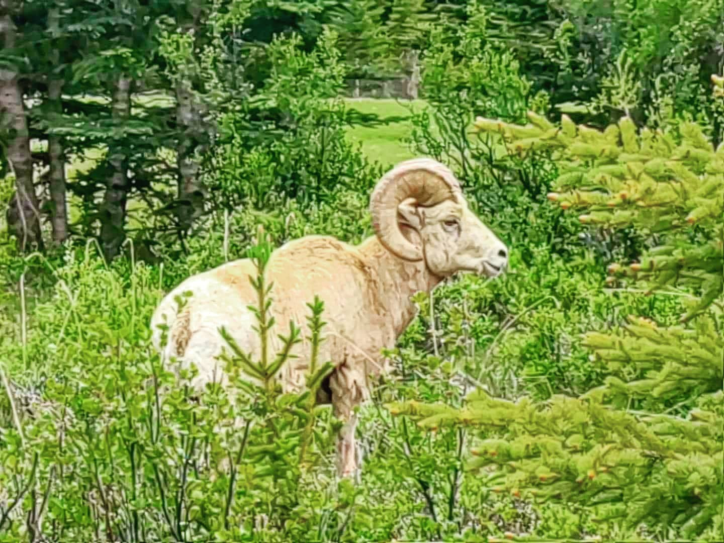
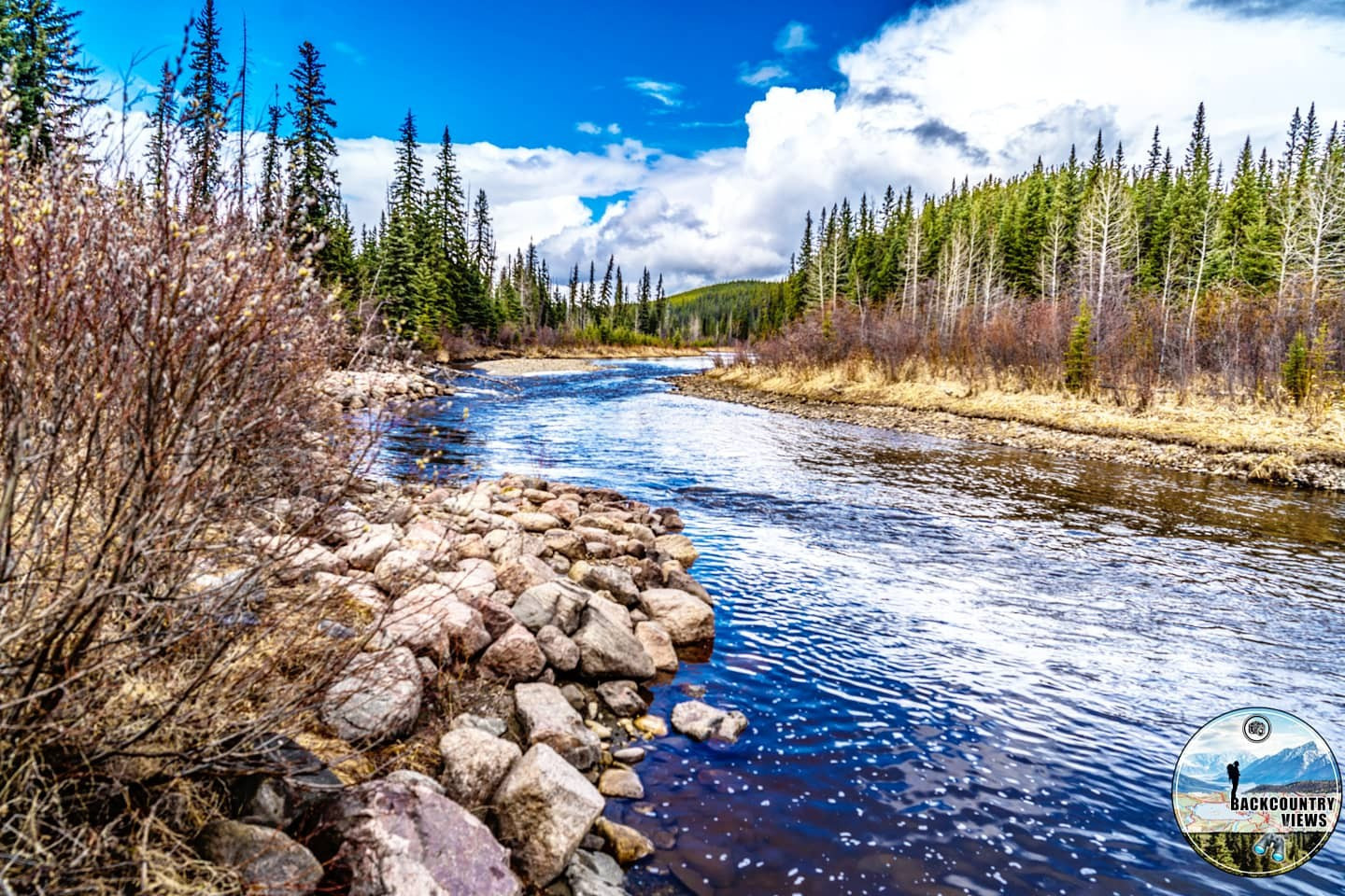
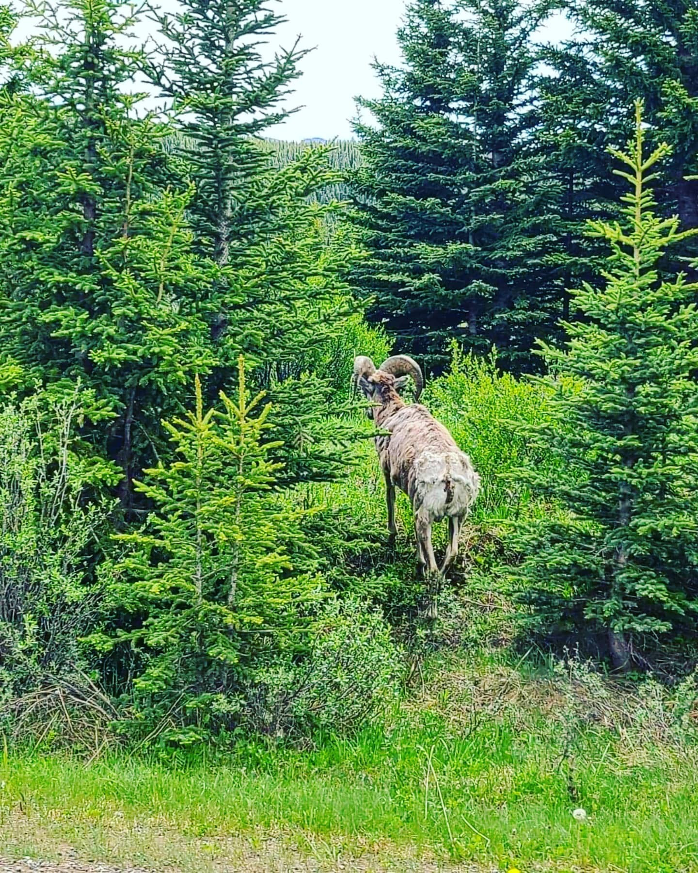
To access this hike park at the Beaverdam Recreation area roughly 4.5km east of Nordegg, the trail begins from the overflow campground. Prior to starting this hike if you are low on water and have a LifeStraw Bottle or water purification tablets, you can grab water from Dutch Creek. There is another little creek as well after the quarry, but I recommend bringing a few bottles with you. I have heard reports of bears on this trail so as always when hiking in the backcountry be Bear Aware. You can view Coliseum Mountain as well as the Brazeau mountain range from this hike.
Distance: 9.7km
Elevation Gain: 44m
To access this trail, go west of the Nordegg turnoff a little bit on Highway 11 and turn right on Shunda Creek Road, follow this till you can turn right on Baldy Mountain Road. Follow this road to Eagle Drive and continue on it to the parking lot.
This popular hike does venture into avalanche terrain quite quickly so keep that in mind if doing this hike in the winter months. With an elevation gain of 701m or 618m depending on which route you choose to take this does provide a great upward hike. I suggest accessing it from Highway 11 on your right heading west past the Beaverdam Provincial Recreational Area as the elevations increases more gradually, as you head to the summit. At the top you will see some stone rubble which is all that is left from the original lookout tower which was the first mountain lookout tower in Alberta.
Distance: 12.67km
Elevation Gain: 618m
Park your vehicle 11km south of the Nordegg turnoff at the Dry Haven Recreation Area. This short hike provides easy access for those staying at the Dry Haven Campground to gain access to Goldeye lake. It features moderate elevation and starts near the Centre for Outdoor Education.
Distance: 3.25km
Elevation Gain: 70m
To access this trail you need to park at an old woodlot 9km east of Nordegg. Here you will find a gravel turnoff on the southside of Highway 11. Follow this road to an open field where you can park. A full day hike that starts on an OHV/ Quadding trail which leads to the summit of Eagle Mountain with unobstructed views of Summer Valley, the Brazeau Lookout tower. Located north of the North Saskatchewan River this is the highest point in this area of the Brazeau Mountain Range and offers amazing views of both the sunrise and sunset, just make sure to plan your trip accordingly.
Distance: 15.27km
Elevation Gain: 717m
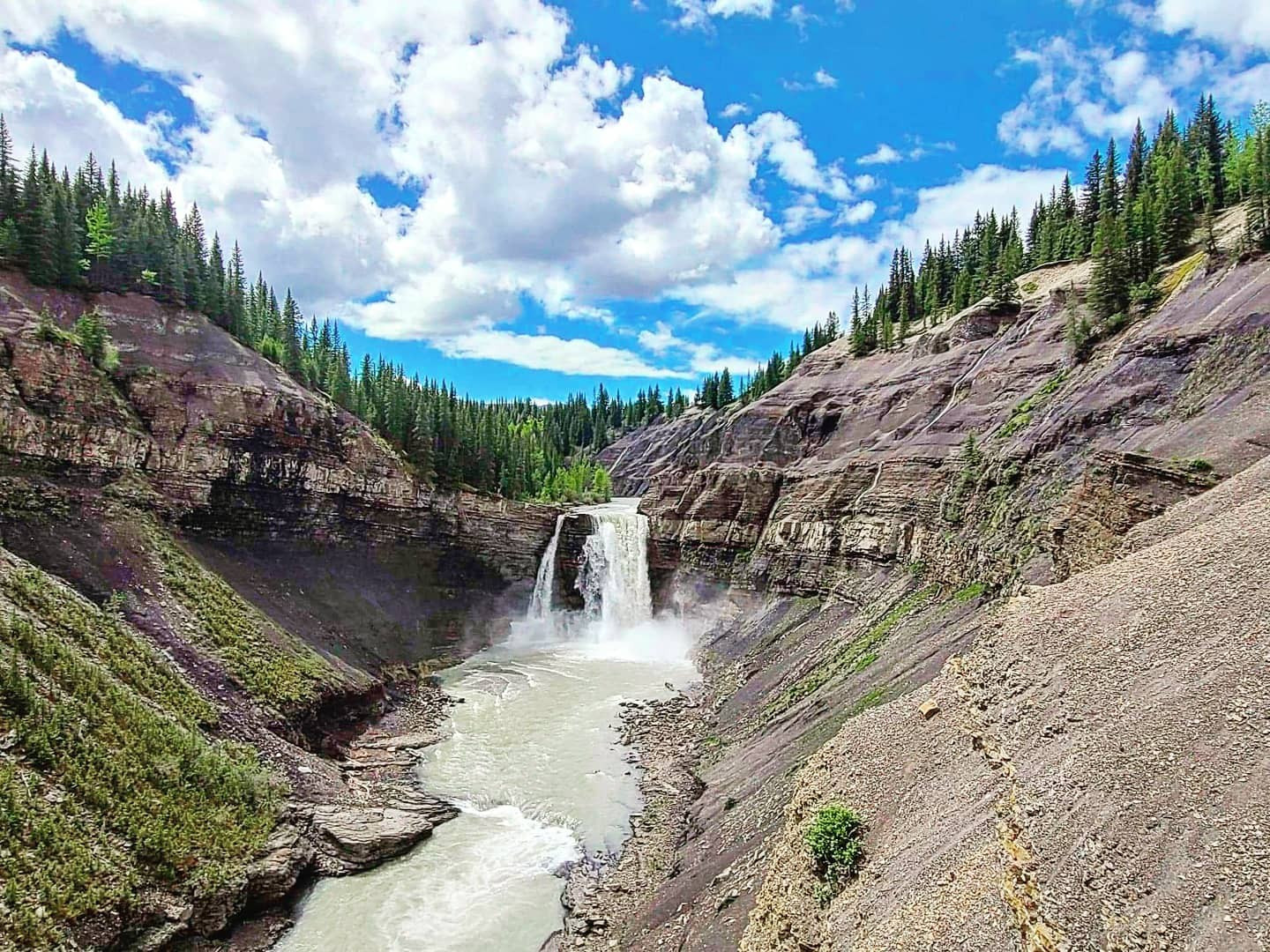
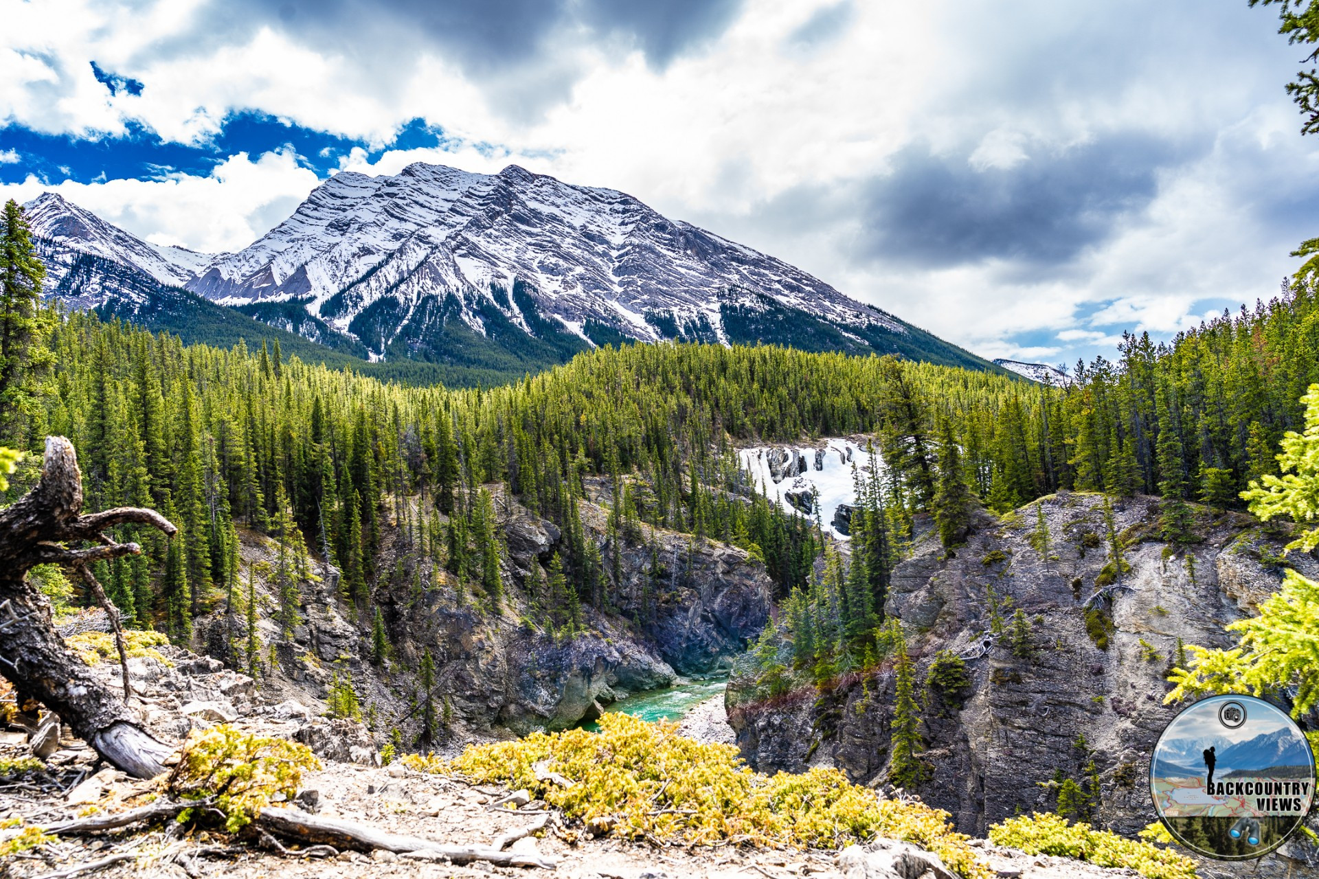
Park your vehicle at the Nordegg Heritage Centre (it’s the yellow building roughly 1km south of Hwy 11 in Nordegg – 4002 Stuart Street, Nordegg, Alberta, T0M 2H0). From its beginning in the south this creek flows north towards Shunda Creek located North East of the Nordegg Heritage Center, East Bush Creek flows down a valley as it makes its way towards the falls. North West of East Bush Mountain, which just happens to be the destination of this hike. Please follow direction in The David Thompson Highway Hiking Guide on page 34 as it is quite easy to take the wrong path while hiking in this area as multiple old logging roads and trail cross your path. With an elevation gain of 116m through a predominantly forested trail as you can see below in the profile. This hike isn’t overly strenuous depending on experience level.
Distance: 4.38km
Elevation Gain: 116m
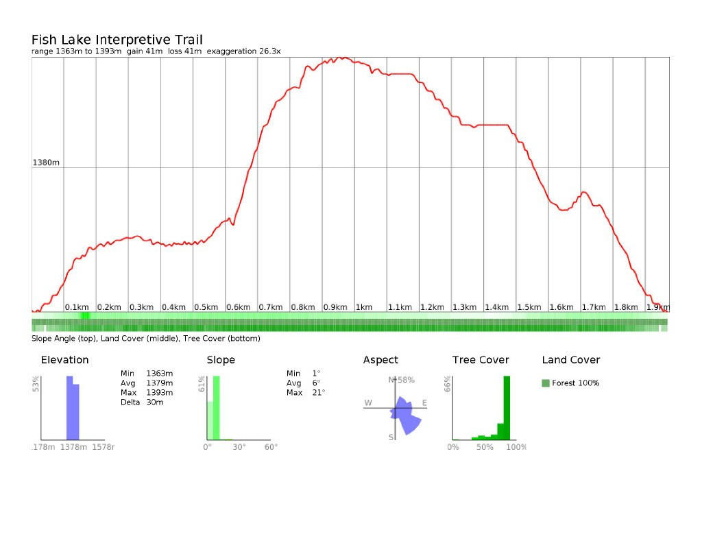
To access this hike turn south off of Highway 11 at the Fish Lake Recreation Area sign roughly 4km past the turnoff to Nordegg. Turn right after 1km at a junction and drive down a gravel road to the parking lot.
This easy hike features trees over 275 years old as well as info on different species which inhabit the area around the lake. A family friendly hike your kids are sure to enjoy, you will also catch glimpses of people hooking fish in the nearby Shunda Lake especially by the first bridge you encounter when heading counter clockwise around the lake as you follow the path, some sections can get muddy if it recently rained. Bug spray is recommended.
Distance: 1.98km
Elevation Gain: 30m
To access this hike turn south off Highway 11 at the Fish Lake Recreation Area sign roughly 4km past the turnoff to Nordegg. Turn right after 1km at a junction and drive down a gravel road to the parking lot. One of the regions most popular brook trout lakes can be hiked around in about 2 hours, along the way you can opt to take the interpretive loop as well. A lot of people fishing use this trail to access their preferred location so be wary and give them ample room so they don’t damage their rods or get their line caught in a branch of a tree, its happened to me here on a few occasions.
Distance: 4.61km
Elevation Gain: 22m
Turn north of Highway 11 at the Goldeye Centre sign around 8km south of the Nordegg turnoff. Drive up this road till you come to a Y in the road, go left, the parking area for Goldeye Lake is just up ahead.
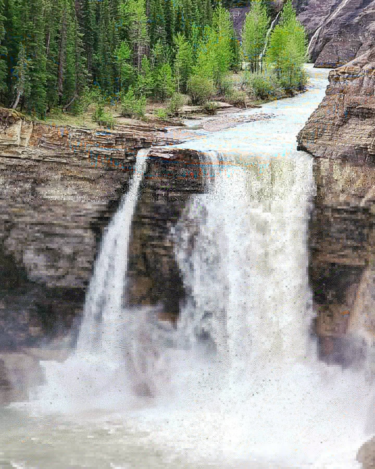
An easy stroll around a lake popular with fishing, which features a waterfall and a section which is covered by a boardwalk. Can be very wet in the spring. Be ion the lookout for people casting lines, as to avoid any possible unwanted injury.
Distance: 3.56km
Elevation Gain: 33m
To access this hike park at the Beaverdam Recreation area roughly 4.5km east of Nordegg, you can also park by the ranger station, but this adds some distance to your hike.
Best done with 2 vehicles this hike has an elevation gain of 702m as you can see in the profile below. The profile only shows the route up for this hike as there are multiple options to descend from. This trail is not recommended in the winter as it does cross a lot of avalanche terrain, unless you have training and feel comfortable doing it, it's one thing to have a course, another to actually use what you learnt in the backcountry.
Distance: 7.25km
Elevation Gain: 701m
Park your vehicle at the Nordegg Heritage Centre (it’s the yellow building roughly 1km south of Hwy 11 in Nordegg – 4002 Stuart Street, Nordegg, Alberta, T0M 2H0). A lot like the Brazeau Lookout trail mentioned above, this hike has a profile of 341m as you can see below, at 1760m above sea level, the benchmark offers great panoramic views of the Nordegg Areas hills. Like the Brazeau Lookout trail, the parking for this hike is at the Nordegg Heritage Center.
Distance: 9.82km
Elevation Gain: 341m
| Trail | Distance | Elevation Gain | Terrain |
| Baldy Fire Lookout via Shunda Mountain Trail | 8.05km | 462m | Steady Hike Up a Fire Road |
| Black Canyon Creek Trail | 18.1km | 203m | Lengthy hike with some steep slopes |
| Brazeau Lookout Trail | 22.52km | 553m | An elevation gain of 1700 Feet |
| Canadian Northern Track | 9.7km | 44m | Long steady hike along an old train track |
| Coliseum Mountain Trail | 12.67km | 618m | Continuous climb followed by easy hike |
| Dry Haven - Goldeye Lake Connection | 3.25km | 70m | Easy hike, usually takes 2hrs |
| Eagle Mountain Route | 15.27km | 717m | Long full day of hiking with some steep slopes |
| East Bush Falls Loop | 4.38km | 116m | Half day easy hike |
| Fish Lake Interpretive Trail | 1.98km | 30m | Easy hike lasting about 1 hour |
| Fish Lake Loop | 4.61km | 22m | Easy hike around a lake |
| Goldeye Lake Trail | 3.56km | 33m | Easy hike that takes 1 to 2 hours |
| Ridgeline Trail | 7.25km | 701m | Steady hike with a steep increase in elevation and exposed slopes |
| Surveyors Benchmark Trail | 9.82km | 341m | Steady hike that passes a few strip mines |
The maps, GPS data and elevations on profiles are provided for reference purposes only and to help you plan you next outdoor adventure. Maps can be used for navigation and you can open them up in Caltopo for a better viewing experience. Backcountry Views makes no guarantees, representations or warranties respecting this data, either expressed or implied. Backcountry Views assumes no responsibility for damages or other liabilities due to the accuracy, availability, use or misuse of the information provided. I use the information provided within this website to help plan my hikes from elevations to different types of terrain. This info is free to use, as I want to help everyone have a safe enjoyable time while hiking, thank you very much. I hope you find this info to be a benefit to you. For updates follow me at backcountryviewsofficial on Instagram.


