
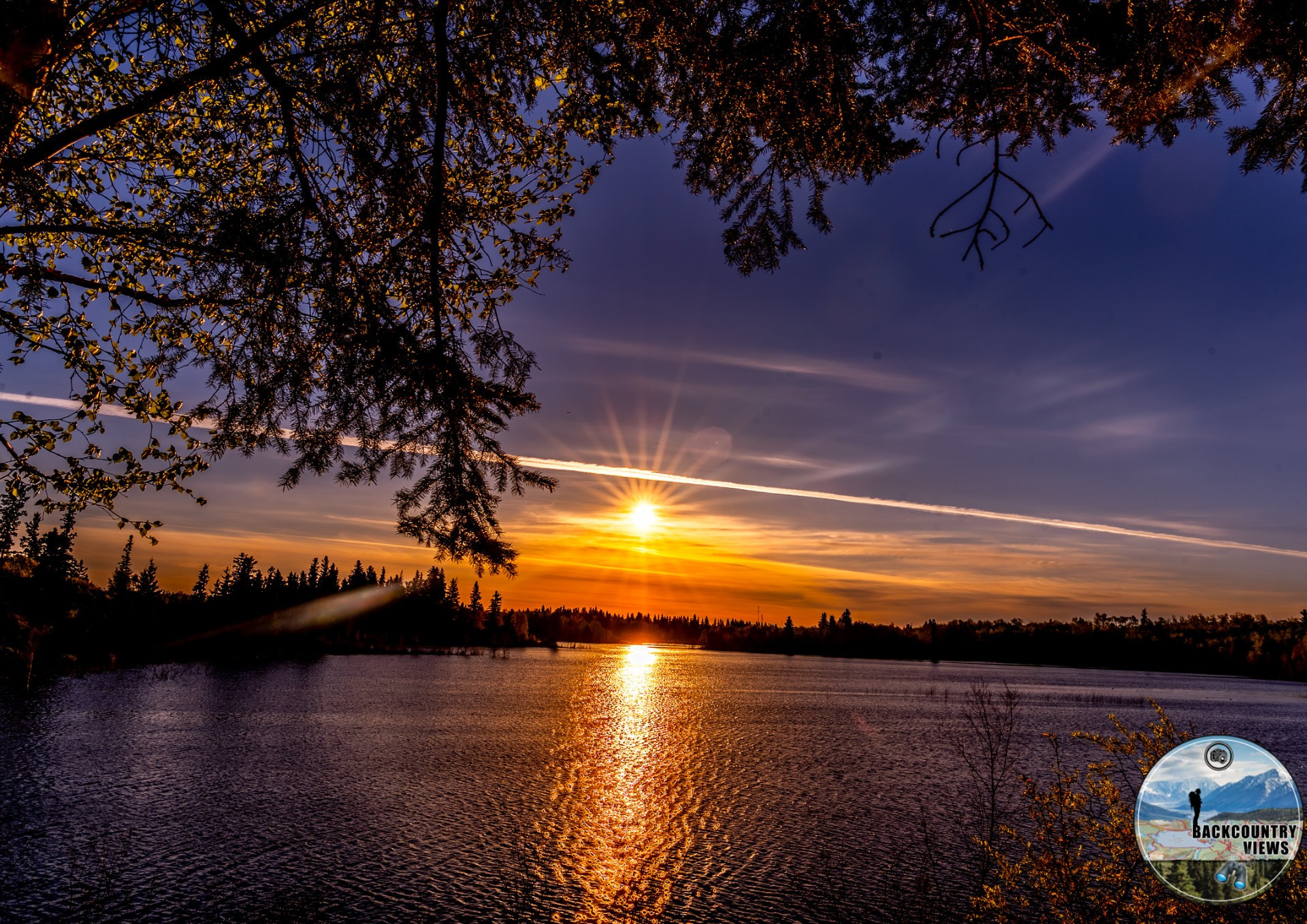
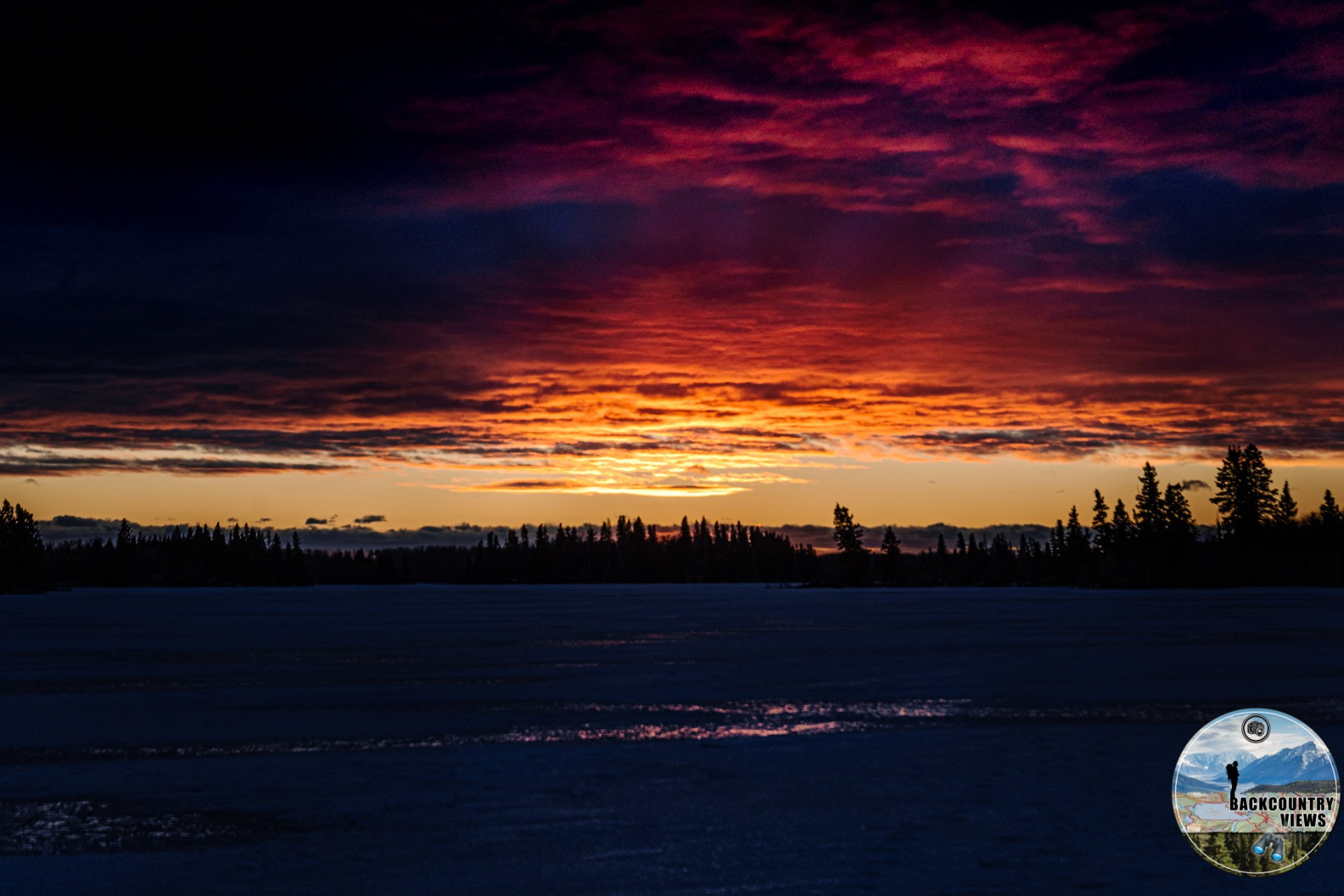
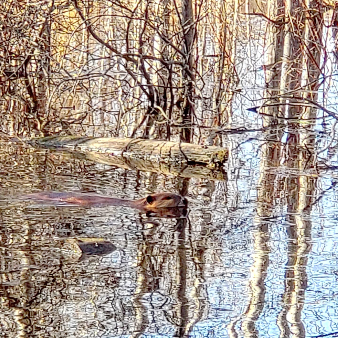
This short 400m loop offers a floating boardwalk over a section of Astotin Lake where beavers, muskrats and waterfowl are almost sure to be seen. Looking west from the boardwalk is Archer Island, with High Island to the NW. Best walked in early morning or late evening, this hike is short but well worth it and accessible to all.
| Trail | Distance | Time | Terrain |
| Living Waters Boardwalk | 400m (loop) | 30 minutes | Flat and Open |
| Amisk Wuche Trail | 2.89km (loop) | 1 hour | Forested with Minor Elevation |
| Beaver Pond Trail | 3.4km (loop) | 1 to 2 hours | Forested with Minor Elevation |
| Lakeview Trail | 3.6km (loop) | 1 to 2 hours | Forested with Minor Elevation |
| Simmons Trail | 3.88km | 1 to 2 hours | Forested with Minor Elevation Changes |
| Shoreline Trail | 3.07km (one-way) 6km (return) |
2.5 hours | Forested with Few Hills |
| Hayburger Trail | 11.92km (loop) | 3 to 4 hours | Forested, Hilly with Minor to Moderate Elevation Changes |
| Shirley Lake Trail | 11.39km (loop) | 3 to 4 hours | Forested, Hilly with Minor to Moderate Elevation Changes |
| Moss Lake Trail | 12.77km (loop) | 4 hours | Forested, Hilly with Minor to Moderate Elevation Changes |
| Tawayik Lake Trail | 15.5km (loop) | 4 to 5 hours | Forested, Hilly with Minor to Moderate Elevation Changes |
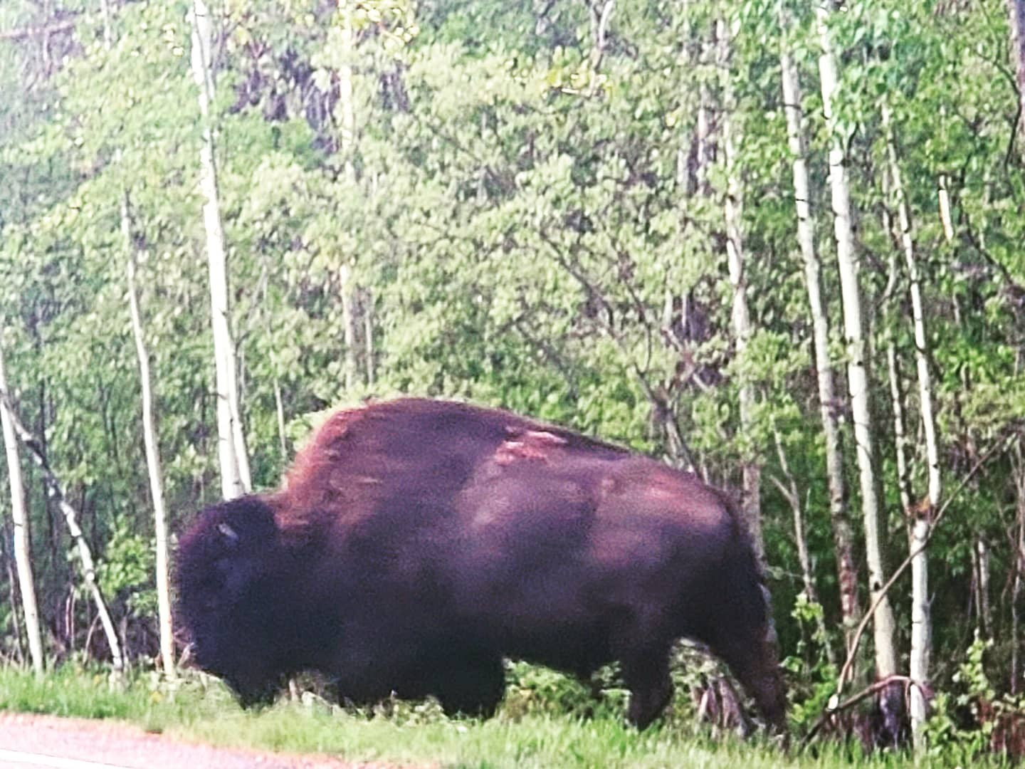
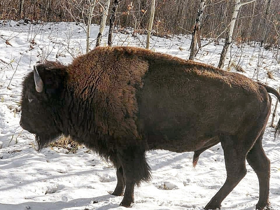
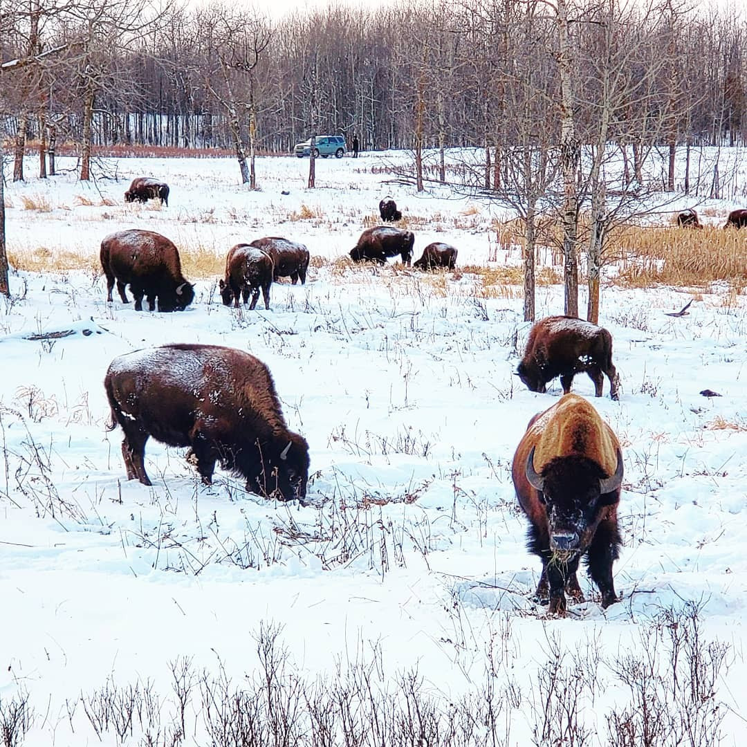
| Wood Bison Trail | 15.85km (loop) | 4 to 5 hours | Forested, Hilly with Minor to Moderate Elevation Changes |
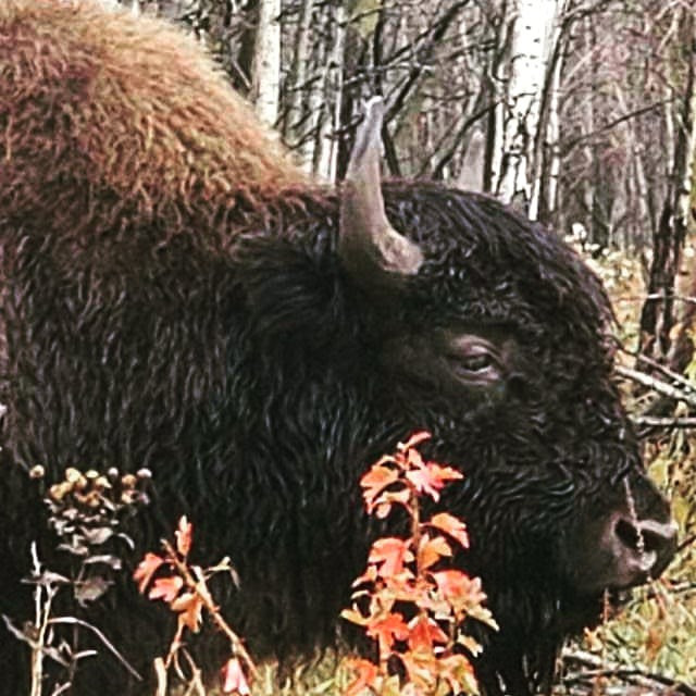
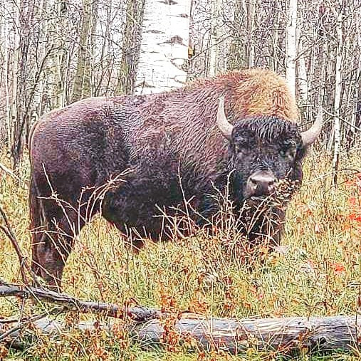
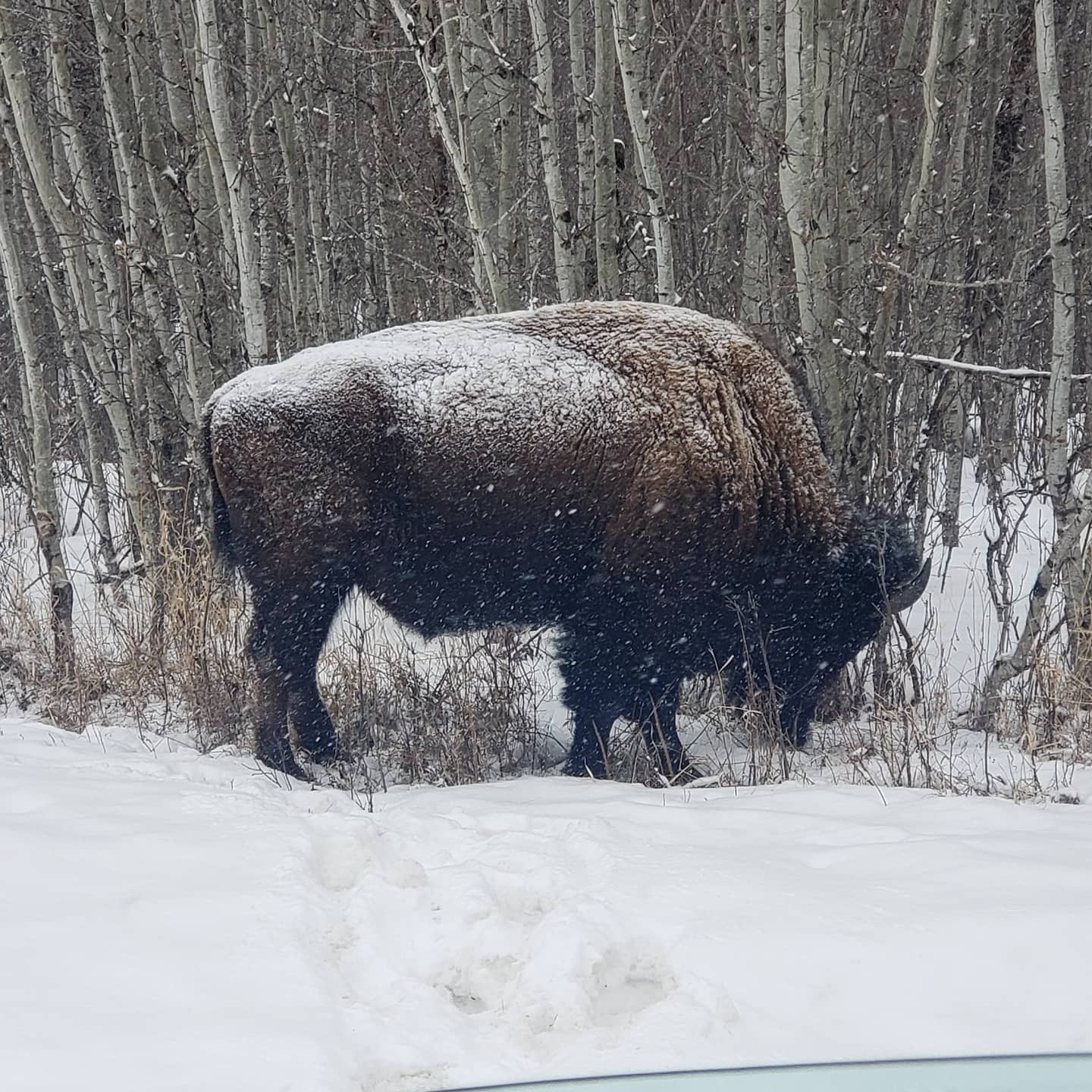
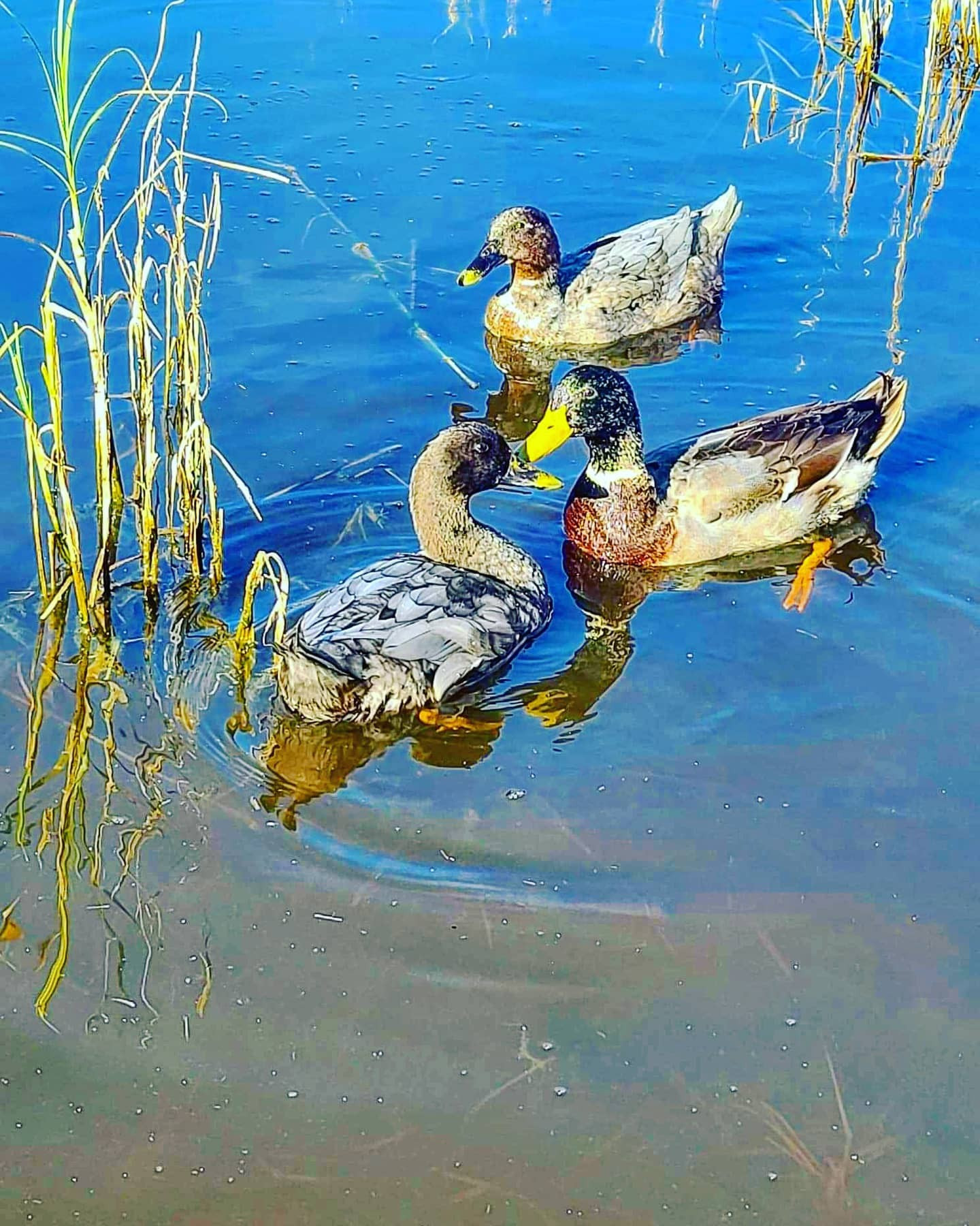
From Beaver lodges and Muskrats swimming in the lake to Deer and Bison activity along this trail, Amisk Wuche is definitely a hike you are going to enjoy. Very soon after walking down a gentle hill you come to a y in the trail. I suggest heading right here, you will see soon why. Within 0.5km after passing a viewing area on your right you are greeted by a boardwalk which guides you across the lake past a beaver lodge on your left and looking southwest another Beaver lodge comes into view. This area surrounding the boardwalk is home to Ducks, Beavers, Canadian Geese, Muskrats and just a general abundance of Birds and Aquatic Life. This is another of my favorite hikes within the National Park.
It is also located close to the Astotin Lake Campground. After the boardwalk, you continue on the trail still following the same lake, a bench is located nearby. At around the 1.3 km mark you start to leave the lake behind and enter a mixed forest. This stretch is home to Deer, Bison, Rabbits and Squirrels as you the trail winds towards the 2km section of this walk. From this point on the original lake you walked across the boardwalk comes into view as well as a small body of water on your right-hand side which features a bench, and is a great spot to view waterfowl. Past this bench within viewing distance is another bench on left overlooking the bigger lake. Look on your right in between these two benches for signs of beat down path that bison use year after year as they travel throughout this area. As you keep going you will notice a few different ponds and small lakes on your right as you return to where the loop started. Another bench is also present. The short hike just to the boardwalk is great for kids as well as adults due to the vast array of waterfowl and aquatic life in this short section of the trail.
Looking for more information? Visit the site here
Distance: 400m (Loop)
Time: 30 minutes
Distance: 2.89km (Loop)
Time: 1 hour
This trail starts off with views of the lake through the trees as you soon come in a clear view of it. Looking NW or SE from the bridge you will see two different beaver dams, and more than likely a beaver itself, moose are known to visit here as well. In just under a km you come to the beginning of the loop, I suggest going left, whichever way you go you will be treated to a sprawling aspen forest, and get the potential opportunity to view Moose, Elk and Bison as well as Deer and Muskrats, and multiple varieties of Birds. You will pass ponds and marshes as you complete the loop, don’t rush, take your time as this is great area to view nature in its entirety.
Distance: 3.4km (Loop)
Time: 1 to 2 hours
As you head North along this trail from the parking lot at Astotin Lake, you will pass by a campsite on your right as well as a doc and another area which is popular with people who are choosing to kayak or canoe around Astotin Lake. Looking to the SW you will see High Island Lake which is one of the multiple islands located along this lake, see map at the top of this page for the names of the other islands. Just after a km of hiking you will come to a fork in the trail. I suggest heading left here, as you continue on your way, you will pass a multitude of ponds and marshes, each home to multiple species from muskrats and beavers to ducks and bison. In the evening the haunting calls of a loon may be heard as well. A beaver lodge located on the return leg of this hike is another popular area for waterfowl.
Distance: 3.6km (Loop)
Time: 1 to 2 hours
After turning left towards Tawayik lake and reaching the parking lot. You head towards Simmons Trail keep an eye out as bison have been known to graze just off from the road, remember that like all trails in the park, dogs must be kept on a leash. Within a few 100m you come to a fork in the path, I suggest heading right, though both offer a great viewing experience. Within 1 km a small lake becomes viewable on your right-hand side, I have seen moose here on multiple occasions. Just before the 2 km mark you come across the Shirley Lake Trail heading east and west, at this point you want to head left if following my directions, after roughly 100 meters you will see a trail heading to the left, this is the return section of the loop.
As you start on the return leg of this trip, a small lake comes into view, this is great chance to view waterfowl, Moose, Muskrat and even the occasional Elk travelling between the two lakes on this trail. Deer have also been spotted here. If you are lucky you may also be able to view Beaver throughout this hike. Bug repellant is recommended if hiking in spring summer or fall.
Distance: 3.88km
Time: 1 to 2 hours
A 3km hike, 6km return loop along the Southern part of Astotin Lake, offers an amazing view of Astotin Lake. Located along this trail is the Beaver Bay Peninsula Area where a washroom and picnic tables are located, from this area views of Griesbach Island to the North are easily seen as well as Crane Island to the Northwest, see above map for more info.
Continuing west on this trail you pass the actual island named Elk Island as you head towards the trails end. This can be hiked in its entirety or in sections, either way you will get to experience a vast abundance of waterfowl and calming lake views. Have seen Bison tracks in the snow along the eastern parts of this trail as well as earing the howling of Coyotes in the late evening along the western section of the Shoreline Trail.
Distance: 3.07km (one-way)
Time: 2.5 hours
As you start out on this trail from the parking lot, easily viewable on the right as you drive north though the park, be sure to keep your eyes open as Bison sometimes frequent the trailhead. Within a few 100 meters on your left-hand side Jordan Lake will come into view. It is a great spot for ducks and Canadian geese and in early morning or late evening you can see the occasional muskrat going about its business As you continue on at around 1.4 to 1.5km you come to s fork in the trail, I recommend heading left for the best experience. At about the 5km mark to 8km mark if you chose to go left you pass a few bodies of water which gives hikers a potential chance to see Bison, Deer or Moose, before they head back towards the area where they chose to go left.
This hike passes through a lot of aspen forested areas providing excellent opportunities for birdwatching as well as wildlife viewing. Also, a potential for bison scat so keep an eye out. Early Spring and late fall also provides a chance to glimpse one of the many moose that inhabit the park due to its multitude of spruce bogs and lakes. Bug repellant would be a good thing to pack when choosing to hike this trail. As you continue on this trail there are multiple small lakes on your right.
Distance: 11.92km (loop)
Time: 3 to 4 hours
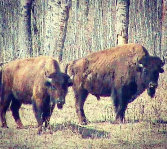
From the Shirley lake trailhead, you venture onto one of my personal favorite hikes within the park. If you plan to hike this during mosquito season be sure to bring bug repellant. I have this trail starting on the return section of Simmons Trail as I find the best views are found going counter-clockwise and if done early in the morning this route offers you the best chance to see wildlife because within 1.3 km a lake is west of you and I have viewed White Tailed Deer there just after day break. From here continue along the trail and within roughly 2.7km km of the trailhead Spruce Island Lake becomes viewable on your left, on your right is also a small lake where Moose have been known to frequent. Spruce Island Lake has a great chance to see waterfowl and the occasional Moose. Between the 3 to 3.5km section of this hike after passing 2 small bodies of water on your right, Paul Lake comes into view on your left, with Shirley Lake on your right. Again, this area provides yet another great spot to view waterfowl and see wildlife. As you continue you pass a few more small lakes on your right-hand side. I had the opportunity to witness an Elk along this trail once in the evening, keep an eye out, you never know. Roughly just after the 5.5km mark Oster Lake comes into view on your left-hand side. Pause and look around as Moose, Elk and Bison tend to be seen here quite often. As you continue, just after the 6 km mark a field starts to open on your left, and you start to see a few picnic tables. This is the Oster Lake Backcountry Group Tenting Area. A great spot to camp as the sunrises here in the morning are sure to wake you up with a smile depending on weather. It is also a great spot to picnic (just be respectful of others who may have the same idea as your or may be camping overnight. Myself I have seen Bison here on multiple occasions as they tend to both drink and graze in this area. Returning to the trail you will proceed through more aspen forest, past a multitude of beaver dams and small ponds. If you don’t mind the distance, you need to hike this trail a few times in different seasons to get the full effect.
Distance: 11.39km (return)
Time: 3 to 4 hours
Located on your left when heading towards Astotin Lake, is a hike which offers great opportunities to encounter Bison, Beavers, Moose, Elk and multiple different species of waterfowl. After starting from the trail head, within roughly 400m you come to a y in the trail which begins the loop section of this hike. If doing this hike in the morning I suggest going left, if in late afternoon or early evening I suggest heading right, both options offer a great hiking experience. For the purpose of this description we will head left. A few 100m after this you get your first glimpse of Moss Lake, a great spot to view waterfowl and the occasional Moose. I highly recommend bug repellant on this hike. As you continue hiking up and down over a few minor hills and past dense vegetation, keep an open eye for signs of Bison – scat as well as tuffs of their fur on tree branches as well as bison tracks. Just before the 5km mark, you will start to pass a lake on your right hand-side. Grab your camera as waterfowl is usually quite abundant here, also keep an eye out for moose tracks as they seem to frequent this lake in the early morning, you never know what you might see. Muskrats are abundant here as well.
As you continue walking around the 8km mark you will see a small lake on your right-hand side prior to passing Jordan Lake on your left hand side at about the 9km mark of this hike. Jordan Lake seems to be a popular area for Bison as I have witnessed them here before. Pause here and scan the water’s surface for muskrat along the shores as well as waterfowl swimming freely. The water on your left as you return to the area where you started the loop is all part of Jordan Lake. Bird lovers will enjoy this trail due to the mixed array of trees encountered during this hike. As Jordan lake is west of the trail, you get to view the sun as its sets, casting a multitude of colours on this lake.
Distance: 12.77km (loop)
Time: 4 hours
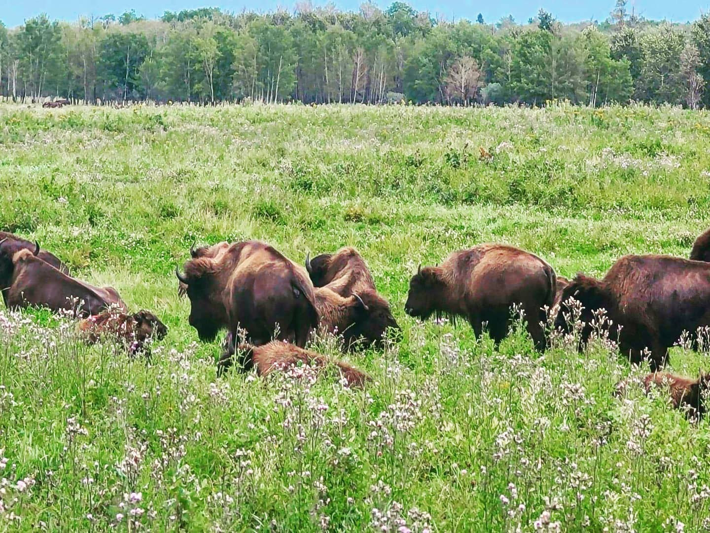
This 15.1 km hike is home to Bison, Elk, Moose, Deer as well as a huge variety of birds. As you start from the trailhead there is bench commemorating the visit of Pope John Paul in 1984. This trail leads you through aspen forest and multiple meadows. After you pass the bench and with Tawayik Lake to the SW, you cross a small wooden bridge, if you look north from here across the lake it is possible to view bison grazing and resting with binoculars, during the summer months. You are greeted with multiple views of this lake as you continue on. The trail starts to open as you reach the southern end of the lake. This area here is great for both bird watching and wildlife viewing.
Bison graze between these 2 lakes as do Elk on occasion, a good percentage of the time Bison will be viewable in this area, just remember they are wild animals and to keep your distance when viewing or photographing them. The lake you see here to the south of Tawayik is known as Little Tawayik Lake. I have viewed Elk here in the morning along its south western shores as well as Bison. As you cross in between these 2 lakes and head NW towards Adamson Lakes, keep an eye out for Bison as they seem to travel parallel to the trail prior to it starting to go north. Adamson Lake is a small lake populated largely by waterfowl which seem to travel between here and Trappers Lake located west of Adamson Lake as do Moose on occasion.
Distance: 15.5km (loop)
Time: 4 to 5 hours
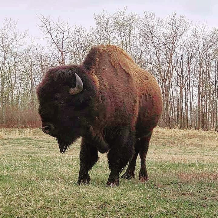
This trail can be extremely muddy, wet ad damp in early spring to mid-summer. The road to the trailhead is located south of the entrance to the park off Highway 16 (turn left for the main area of Elk Island National Park, right for Wood Bison Trail. At 15.6 km this is currently the longest hike within the park’s boundaries and my personal favorite. This trail is made up of predominantly aspen forest which the parks Wood Bison have called home since 1963. Added to the park in 1947 the Wood Bison Trail is home to a wide variety of wildlife. Varieties ranging from Moose, Bison, Elk, Coyotes, Deer, Muskrats, Squirrels as well as a huge assortment of birds and waterfowl.
As you start out on this trail you pass through a wildlife gate right of the washrooms. Heading clockwise from the gate you passed through gives way to thick brush and dense forest, but at about the 1.5km mark keep an eye out for one of the parks many Moose who seem to frequent the next 3 kms as you approach the lake, a herd of Elk is known to frequent this area as well, have heard calls multiple times in the fall along this section. Flyingshot Lake appears on your right as you continue, this area is another great place to view waterfowl within the park. As you continue on the trail, keep an eye open for tuffs of Bison fur along any of the many game trail along this path. After a light hill on the trail, you come across an open field on your left which has proven to contain Bison on cool summer days.
The final stretch of the trail prior heading east back to the parking lots crosses a boardwalk where signs of Moose activity can often be seen. Also be aware on this trail as a multitude of Bison forage here and can be spooked quite easily. This leads them to bolt from their position running away from any unknowing threat they assume may be there. I have startled them on more occasions than one and seen them bolt ahead of me in the distance.
Distance: 15.85km (loop)
Time: 4 to 5 hours
The maps, GPS data and elevations on profiles are provided for reference purposes only and to help you plan you next outdoor adventure. Maps can be used for navigation and you can open them up in Caltopo for a better viewing experience. Backcountry Views makes no guarantees, representations or warranties respecting this data, either expressed or implied. Backcountry Views assumes no responsibility for damages or other liabilities due to the accuracy, availability, use or misuse of the information provided. I use the information provided within this website to help plan my hikes from elevations to different types of terrain. This info is free to use, as I want to help everyone have a safe enjoyable time while hiking, thank you very much. I hope you find this info to be a benefit to you. For updates follow me at backcountryviewsofficial on Instagram.


