
For this trail park you vehicle off of Highway 11, roughly 60km south of the Nordegg turnoff on the north bank of Bridge Creek. This scramble/ bushwhack follows a stream bed to a waterfall. The beginning of this trail shares the path with the Mount Ernest Ross Route.
Distance: 1.91 km (one-way)
Elevation: 178m
From the Nordegg turnoff head east on Highway 11 for roughly 2.3km before turning left (south) onto the Forestry Trunk Road towards Ram Falls. Follow this road for roughly 57km and turn west onto Hummingbird Creek Road. Follow Hummingbird Creek Road for 10km to the end. This rough dirt road features multiple hills and sharp turns along its path. I recommend using a truck with 4x4 though I have seen cars on it before.
While you can access this trail from the Siffleur Falls trailhead, I chose to start it near the end of the Onion Lake Trail as it provides from a more scenic hike in my opinion. This hidden gem located in the Ram Range of Mountains Mount William Booth on its west side for a nice backdrop.
Distance: 17.11km (one-way)
Elevation Gain: 248m
62km south of the Nordegg turnoff, pull into and park at the Siffleur Falls staging area. This trail turns right prior to the Topham suspension bridge over the North Saskatchewan River after starting at the Siffleur Falls Parking lot. You really get a nice introduction here to the Kootenay plains.
Distance: 1.43km (one-way)
Elevation Gain: 5m
Park on the westside of Highway 11 59km south of the Nordegg turnoff. With an elevation of only 66m leads to what would be considered a flagpole with the Canadian Flag attached. Preachers point and Abraham Lake can also be viewed from this relatively easy hike.
Distance: 0.74km (one-way)
Elevation Gain: 66m
62km south of the Nordegg turnoff, pull into and park at the Siffleur Falls staging area. This trail starts to the left of the washrooms. This easy hike leads to an old Stoney cemetery while passing the area where the Siffleur River and The North Saskatchewan River join offering some great sunrise and sunset photos.
Distance: 3.46km (return)
Elevation Gain: 22m
Follow Highway 11 65km south of the Nordegg turnoff and park north of the Creek. With an elevation of 760m as you make you way to Kinglet Lake, make sure to have ample water especially in the summer. With an area to camp at the lake, I recommend doing this hike in two days as the views of the stars here are something to behold. The beginning of this hike shares the path with the Tuff Puff Trail.
Distance: 10.08km (return)
Elevation Gain: 760m
62km south of the Nordegg turnoff, pull into and park at the Siffleur Falls staging area. After parking at the Siffleur Falls Area and following the trail over the first suspension bridge, this hike cuts right as you proceed to Loudon Creek. At Loudon creek you can refill your LifeStraw bottle or water bottle if you have water purification tablets. This is an area favored by fisherman, check the regulations prior to fishing here.
Distance: 15.06km (return)
Elevation Gain: 90m
For this trail park you vehicle off of Highway 11, roughly 60km south of the Nordegg turnoff on the north bank of Bridge Creek. At just over 8km return this hike features 966m of elevation and this trail starts heading up after roughly 5 minutes around 2/3 of the way up this hike offers great views of the Kootenay Plains. From here it is a scramble to the top, make sure you have adequate hiking boots for this trip. As this hike is barren near the top remember to have sunscreen and check the weather prior to undertaking this climb.
Distance: 8.33km (return)
Elevation Gain: 966m
This hike follows the North Saskatchewan river and can be used as a return trip when hiking the Whiterabbit Recreation Trail. Hiking poles are recommended.
Distance: 2.59km (one-way)
Elevation Gain: 73m
From the Nordegg turnoff head east on Highway 11 for roughly 2.3km before turning left (south) onto the Forestry Trunk Road towards Ram Falls. Follow this road for roughly 57km and turn west onto Hummingbird Creek Road. Follow Hummingbird Creek Road for 10km to the end. This rough dirt road features multiple hills and sharp turns along its path. I recommend using a truck with 4x4 though I have seen cars on it before.
A return trip of just over 23km that is shared with horse riders, and an access to the Farley Lake Trail. Starting from the end of Hummingbird Creek Road, this hike offers a great overnight trip as well amazing views with an elevation gain of 217m.
Distance: 28.19km (return)
Elevation Gain: 217m
62km south of the Nordegg turnoff, pull into and park at the Siffleur Falls staging area. The Siffleur Benches Trail makes for a scenic walk as it follows the Siffleur River and loops around back to the Whiterabbit Recreation Trail. A lot of different trails criss-cross this area, so be aware as you proceed with this hike.
Distance: 1.50km
Elevation Gain: 42m
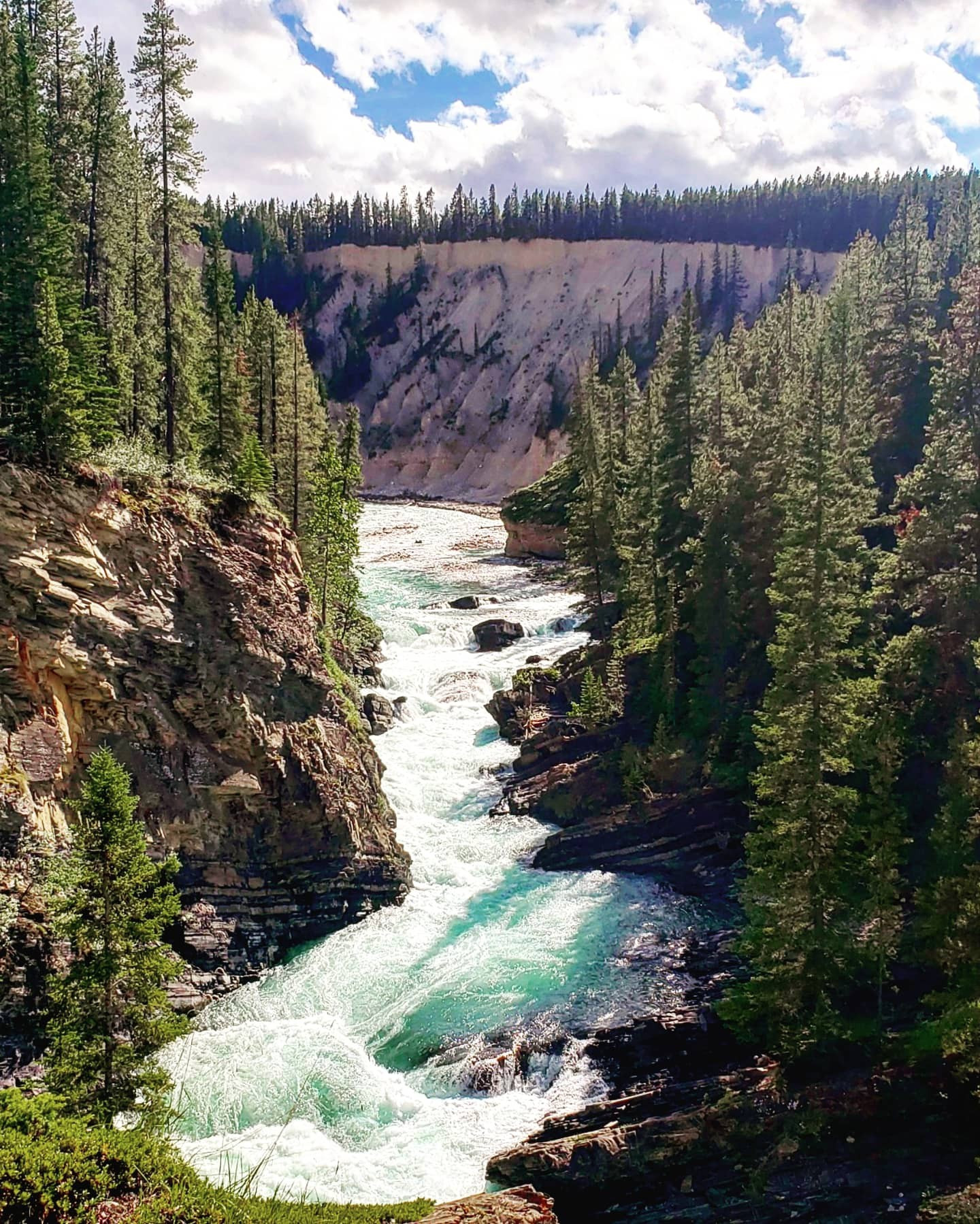
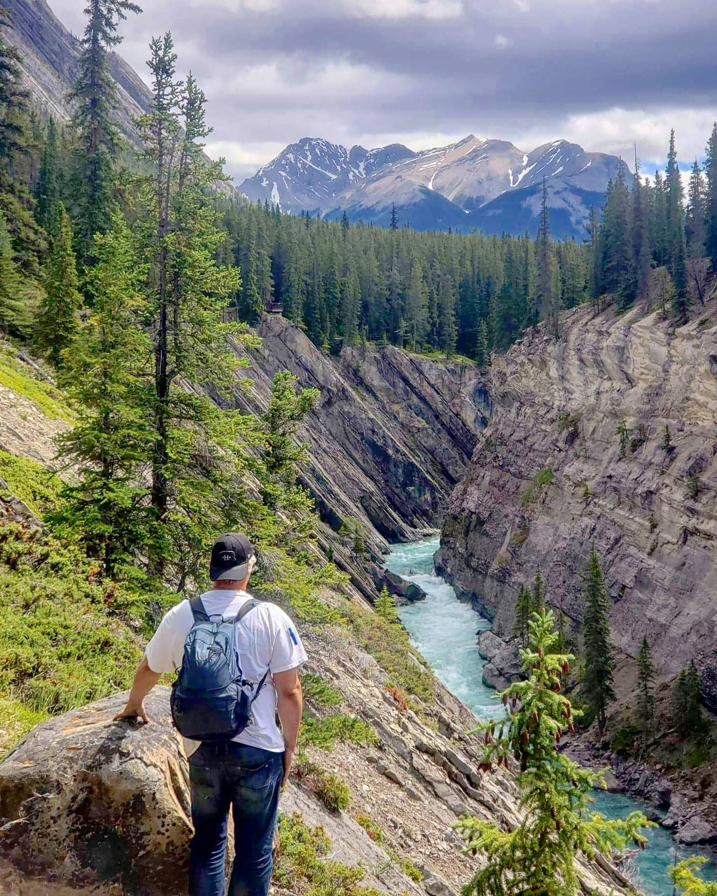
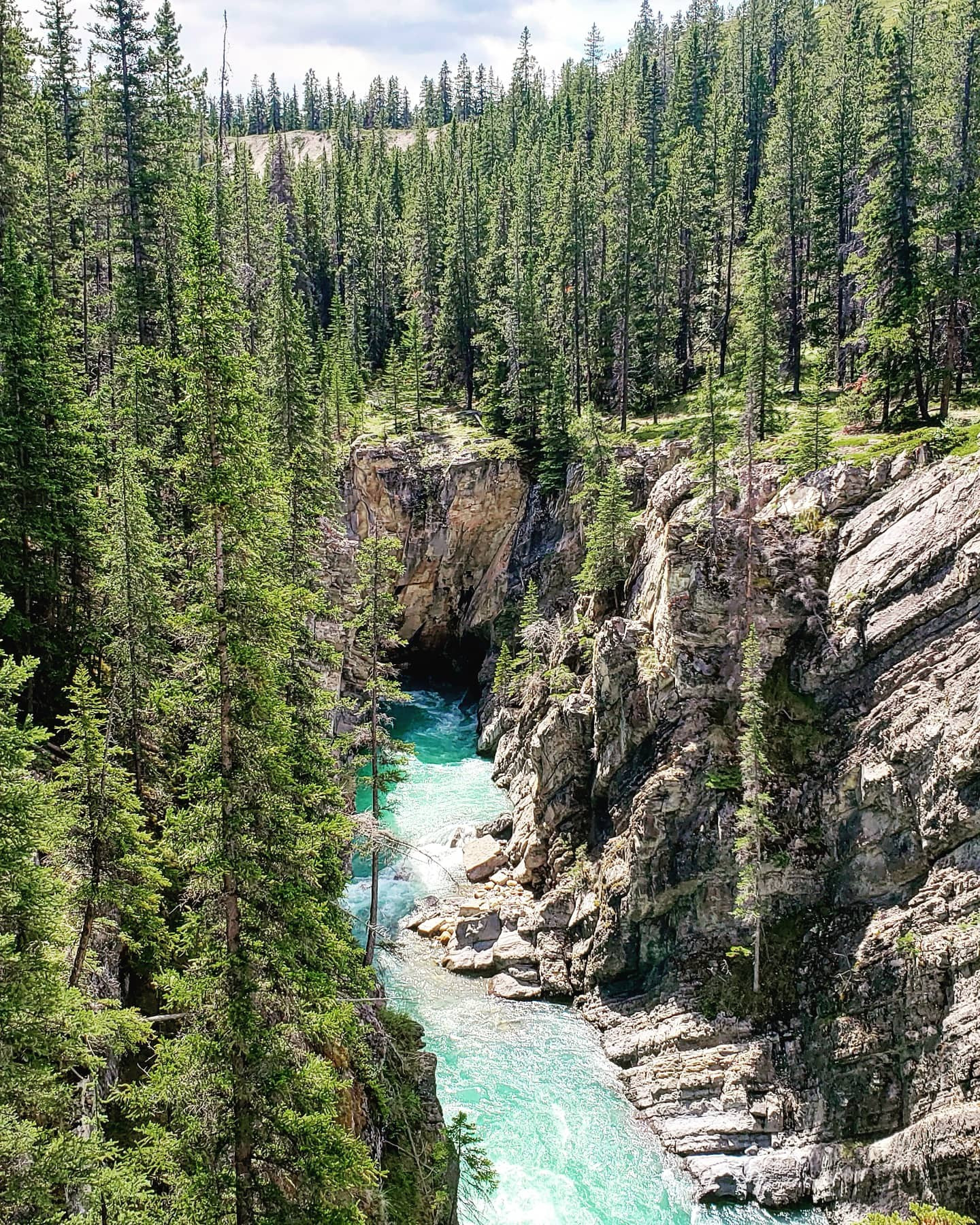
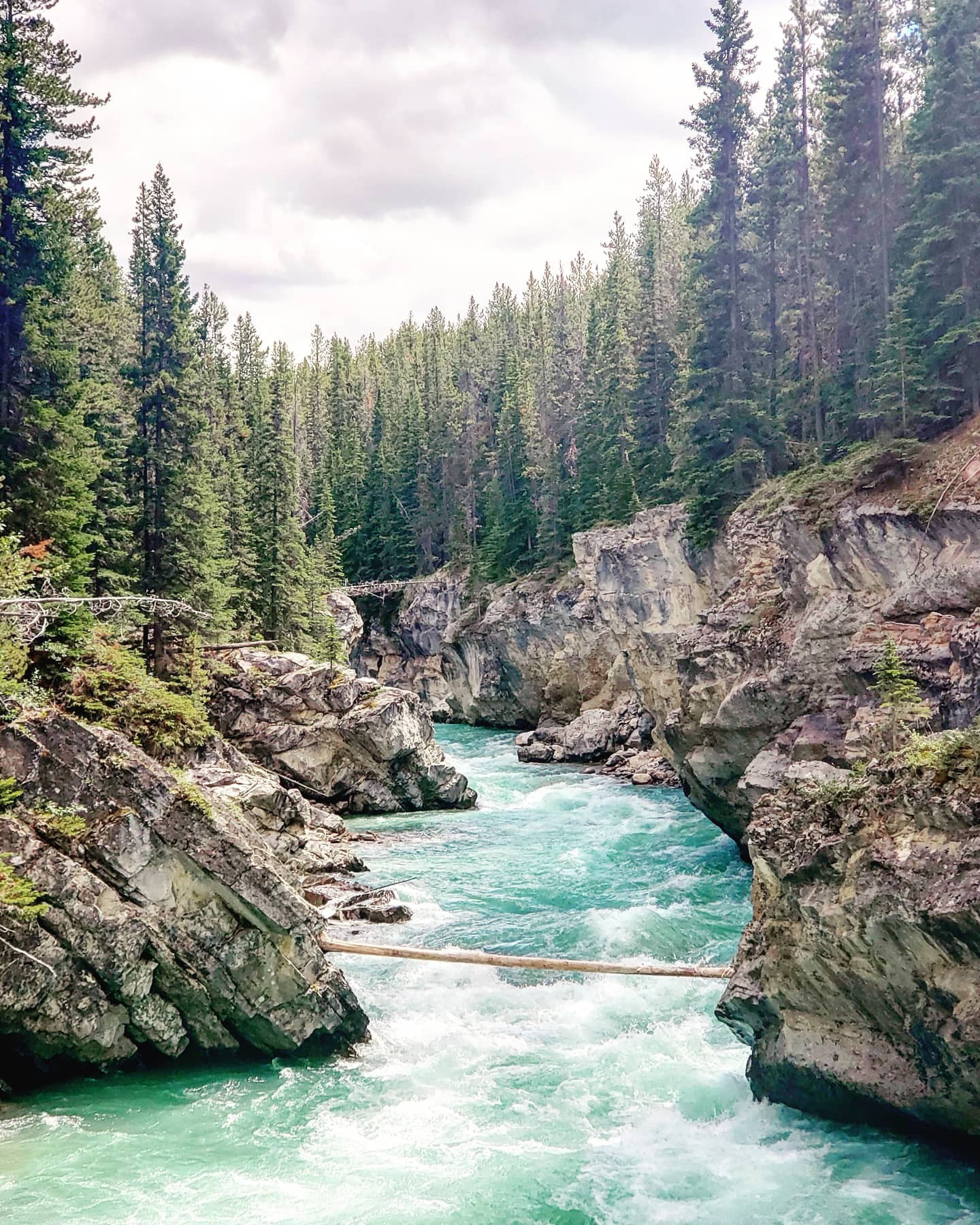
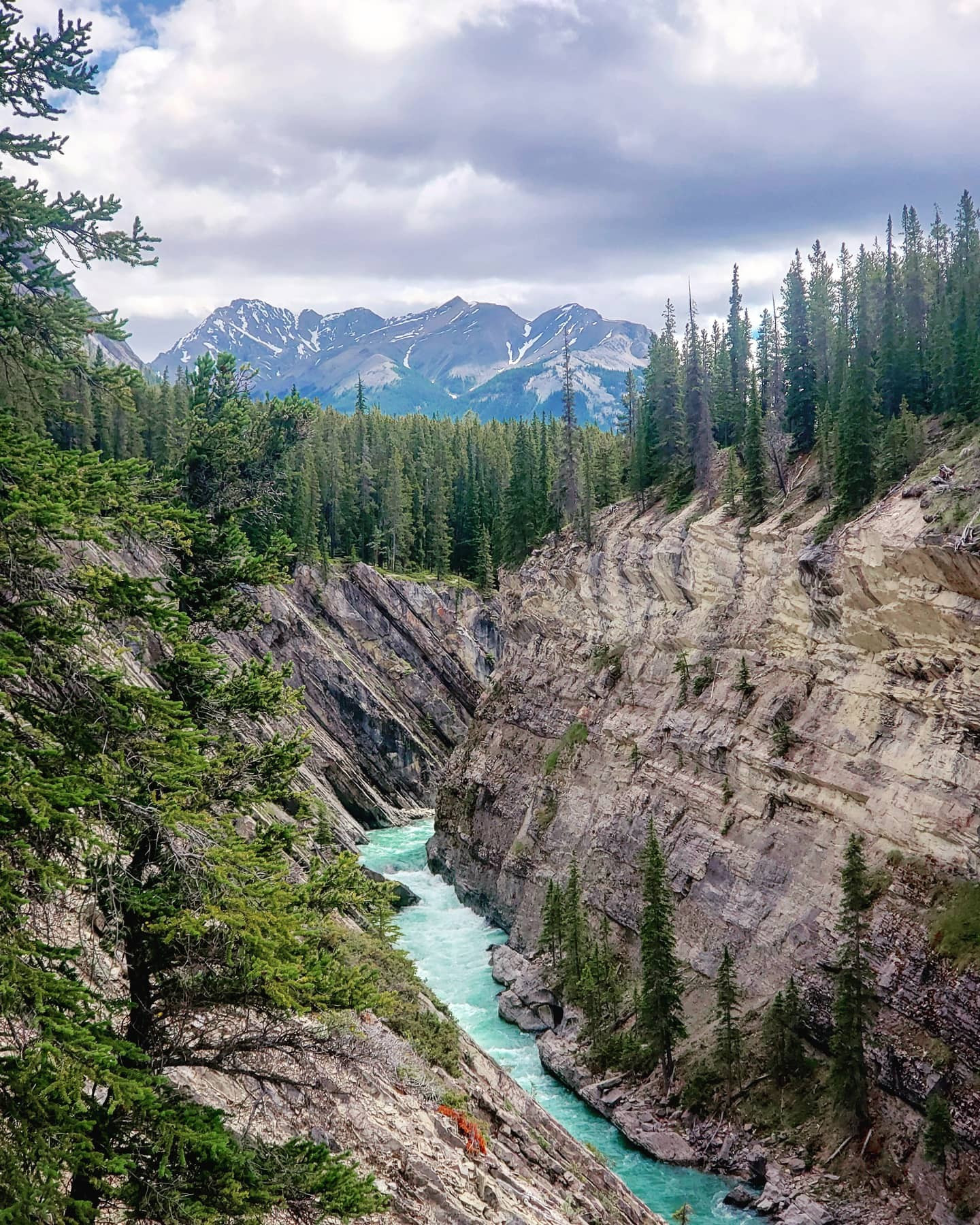
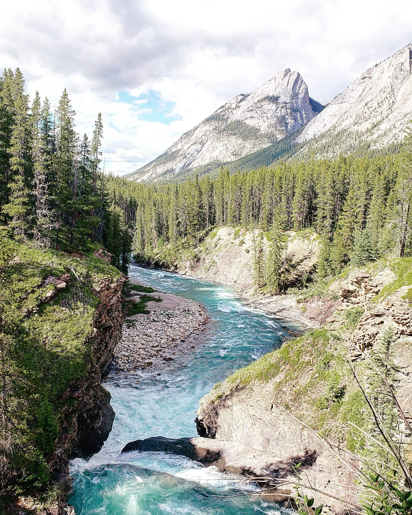
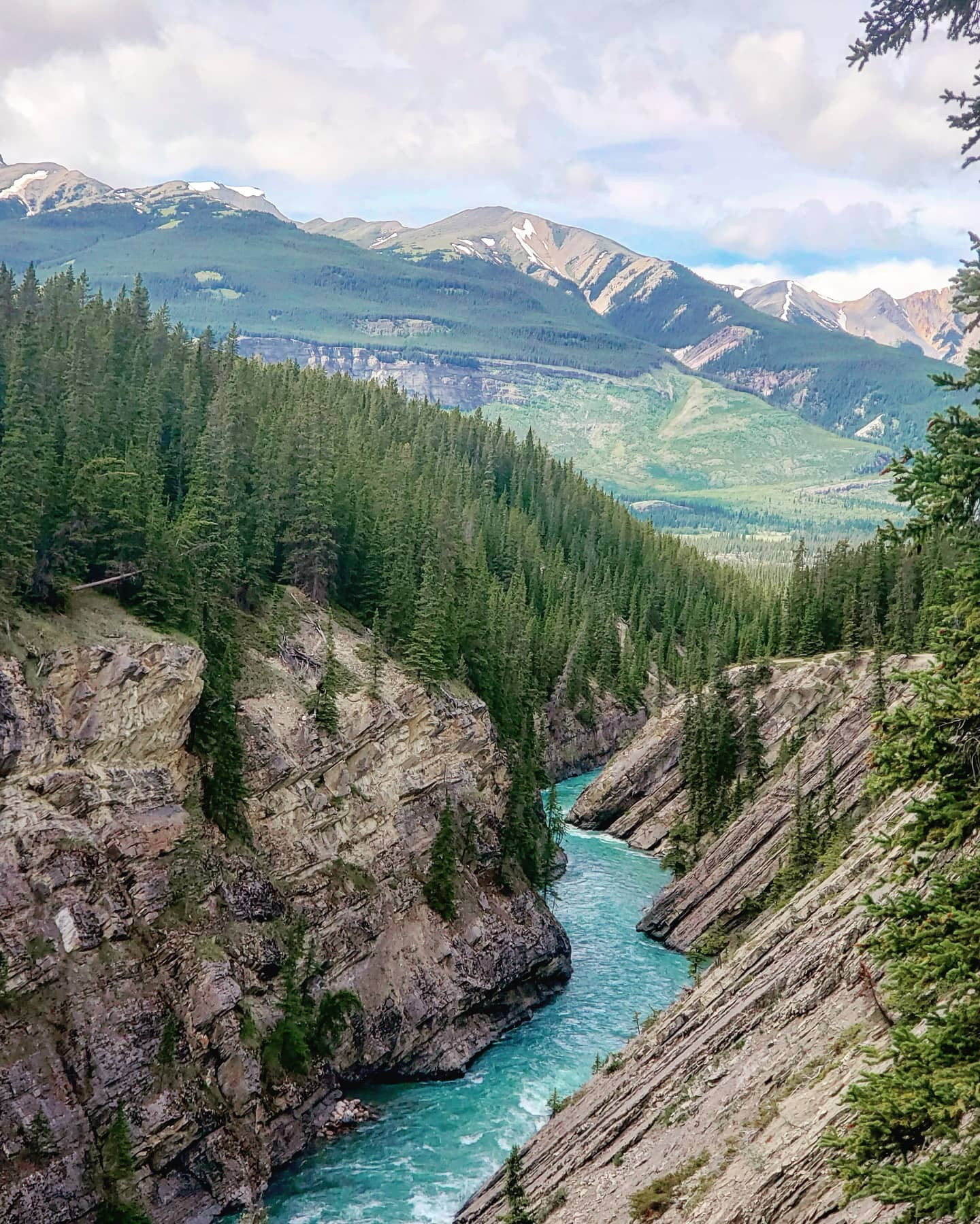
Probably one of the most popular hikes in David Thompson Country, with a total elevation of 144m that you barely notice this hike cross the North Saskatchewan River and Siffleur river by suspension bridges and both offer great photo opportunities. In the winter MICROspikes are recommended. Be sure to carry bear spray as each year multiple reports of bears sightings are recorded here. This hike offers picturesque views of the Siffleur River Canyon but don’t get too close as the banks are very steep and a fall could be life threatening. There is a memorial on the rock near the first falls dedicated to a hiker who lost his life on this trail. While most turn around at the 3.5km mark, you can continue at your own risk as the trail past here is unmaintained and does require some route-finding skills. On weekends and holidays, I suggest getting here early as the parking lot does fill up fast. This hike offers some of the nicest views within the Kootenay Plains Area hence the reason it is so popular.
Distance: 7.07km
Elevation Gain: 144m
62km south of the Nordegg turnoff, pull into and park at the Siffleur Falls staging area. Not to be confused with the Terrace trail near Kananaskis Village this hike with 102m of elevation starts at the Siffleur Falls parking area. Upon crossing the Topham Suspension Bridge this hike veers right and offers amazing views before looping back and following the eastern shore of the North Saskatchewan River. At just under 7km return this trail is sure to be a family favorite, do keep in mind you are in bear country so be prepared and have bear spray in an easily accessible spot, so you can get it within a moments notice.
Distance: 6.89km (return)
Elevation Gain:102m
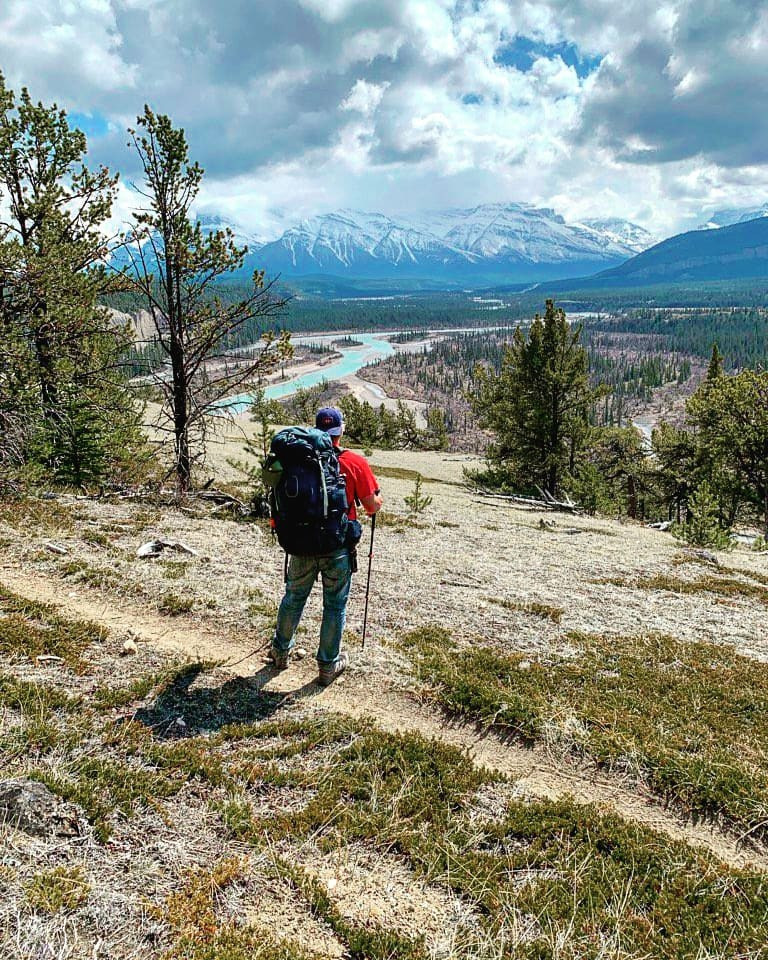
Follow Highway 11 65km south of the Nordegg turnoff and park north of the Creek. Like its name says, this tough hike with an elevation gain of 950m could have you puffing pretty good as you reach its summit at 2330m above sea level. From its summit, the views of the surrounding peaks make you glad you chose this adventure. Some of the nicest views in Kootenay Plains can be found from this summit.
Distance: 11.28km (return)
Elevation Gain: 950m
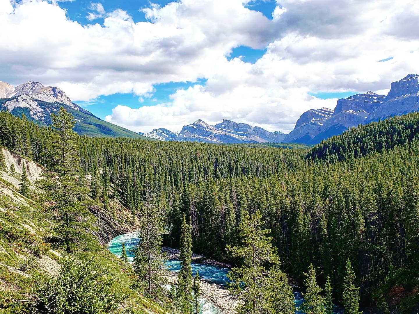
62km south of the Nordegg turnoff, pull into and park at the Siffleur Falls staging area. This roughly 21km return hike does feature some elevation gains as you can see in the profile below offers an opportunity to see the elk and rabbits as well as different species of birds and features open meadows and fantastic views of Tuff Puff and Two O’Clock Ridge as well as offering an open field with a great view of Preachers point which gives you a great spot to have a snack while taking in the scenery.
Distance: 10.31km (one-way)
Elevation Gain: 163m
| Trail | Distance | Elevation Gain | Terrain |
| Bridge Creek Trail | 1.91km (one-way) | 178m | Scramble/bushwhack along stream bed to a waterfall |
| Farley Lake Alternate Trail via Onion Lake Trail | 17.11km (one-way) | 248m | Steady rugged hike through the forest |
| Figure Eight Walk a.k.a. Kootenay Plains Walk | 1.43km (one-way) | 5m | Very easy hike |
| Flag Hill Trail | 0.74km (one-way) | 66m | Easy Hike through grassland and forest |
| Heritage Trail | 3.46km (return) | 22m | Easy hike through forest and grassland |
| Kinglet Lake Trail | 10.08km (return) | 760m | Advanced leg burner to the top |
| Loudon Creek Trail | 15.06km (return) | 90m | A steady easy hike with minor elevation |
| Mount Ernest Ross Route | 8.33km (return) | 966m | Advanced technical climb |
| North Saskatchewan River Trail | 2.59km (one-way) | 73m | Easy hike with a scrambling section |
| Onion Lake Trail | 28.19km (return) | 217m | An upward backcountry hike |
| Siffleur Benches Trail | 1.50km (one-way) | 42m | A forested path with a small scramble section |
| Siffleur Falls Trail | 7.07km (one-way) | 144m | A mix of boardwalks and beat down paths toward the first falls |
| Terrace Trail - Kootenay Plains | 6.89km (return) | 102m | Advanced hike, very steep slopes |
| Tuff Puff Trail | 11.28km (return) | 950m | Steady walk with a scramble |
| Whiterabbit Recreation Trail | 10.31km (one-way) | 163m | Forested trail, steep climb |
The maps, GPS data and elevations on profiles are provided for reference purposes only and to help you plan you next outdoor adventure. Maps can be used for navigation and you can open them up in Caltopo for a better viewing experience. Backcountry Views makes no guarantees, representations or warranties respecting this data, either expressed or implied. Backcountry Views assumes no responsibility for damages or other liabilities due to the accuracy, availability, use or misuse of the information provided. I use the information provided within this website to help plan my hikes from elevations to different types of terrain. This info is free to use, as I want to help everyone have a safe enjoyable time while hiking, thank you very much. I hope you find this info to be a benefit to you. For updates follow me at backcountryviewsofficial on Instagram.


